


Garmin Yellow Sea Coastal Charts BlueChart g3 Vision | VAE002R | microSD/SD
Garmin Yellow Sea Coastal Charts BlueChart g3 Vision | VAE002R | microSD/SD
Model Number: 010-C0877-00
In stock
 WhatsApp
 SMS - Text us!
 Email Us!
 Help Desk

Tech Specs
In The Box
Do you have an old GPS unit lying around? The GPS Nation Trade In and Up program is a great way to trade in your old and used GPS for credit towards a new GPS. The choice is entirely yours! We’ve made the process simple and streamlined. Follow these simple steps, and you will be on your way to receiving credit towards your brand new GPS!
1. Get a quote
To get your free quote, provide your GPS type, manufacturer, model, and condition. Within 24 hours, you will receive a quote for the trade-in value of your current product. The GPS trade-in/trade-up form is at the bottom of this page.
2. Ship your product(s) for trade
After accepting our offer, pack your product(s) safely and ship them to us using the pre-paid shipping label provided to you. We will provide a confirmation email when your trade-in arrives at our warehouse. You have 30 days from the date you complete your on-line trade to ship the product to GPS Nation.
3. Make your purchase
Once we receive your product at our warehouse and we validate the stated condition, we will send you a confirmation email. If you elect to receive credit towards a new GPS at gpsnation.com, your store credit will be issued, and you are free to make your purchase.
Manual & Warranty
 Garmin Warranty
Reviews
Ask a Question
Tech Specs
In The Box
Trade-In
Do you have an old GPS unit lying around? The GPS Nation Trade In and Up program is a great way to trade in your old and used GPS for credit towards a new GPS. The choice is entirely yours! We’ve made the process simple and streamlined. Follow these simple steps, and you will be on your way to receiving credit towards your brand new GPS!
1. Get a quote
To get your free quote, provide your GPS type, manufacturer, model, and condition. Within 24 hours, you will receive a quote for the trade-in value of your current product. The GPS trade-in/trade-up form is at the bottom of this page.
2. Ship your product(s) for trade
After accepting our offer, pack your product(s) safely and ship them to us using the pre-paid shipping label provided to you. We will provide a confirmation email when your trade-in arrives at our warehouse. You have 30 days from the date you complete your on-line trade to ship the product to GPS Nation.
3. Make your purchase
Once we receive your product at our warehouse and we validate the stated condition, we will send you a confirmation email. If you elect to receive credit towards a new GPS at gpsnation.com, your store credit will be issued, and you are free to make your purchase.
Manual & Warranty
Overview
Garmin Yellow Sea Coastal Charts BlueChart g3 Vision (VAE002R) – microSD/SD Card
Introduction
The Garmin Yellow Sea Coastal Charts BlueChart g3 Vision delivers precision navigation specifically engineered for the complex coastal waters of the Yellow Sea, South Korea, and the East China Sea region. This microSD/SD chart card integrates official hydrographic data with high-resolution satellite imagery to provide boaters and commercial fishing operators with the depth detail and geographic accuracy needed to navigate shallow, dynamic marine environments with confidence. Whether you're operating in crowded shipping lanes or remote coastal passages from Wenzhou to Dandong, this chart transforms your compatible Garmin chartplotter into a specialized navigation system for Asian Pacific waters.
Key Features
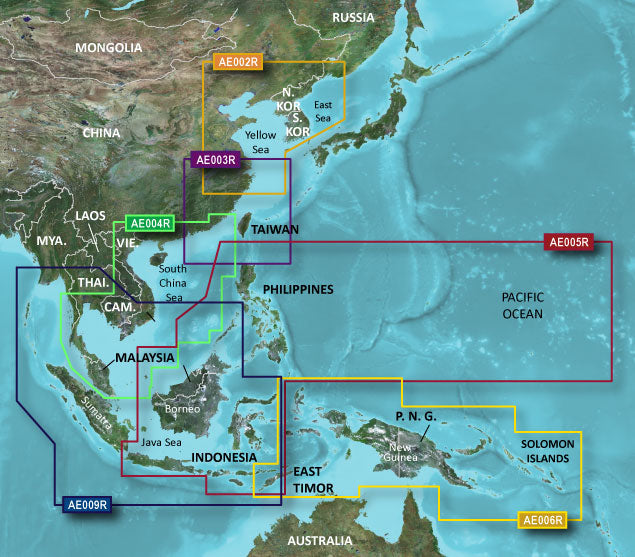
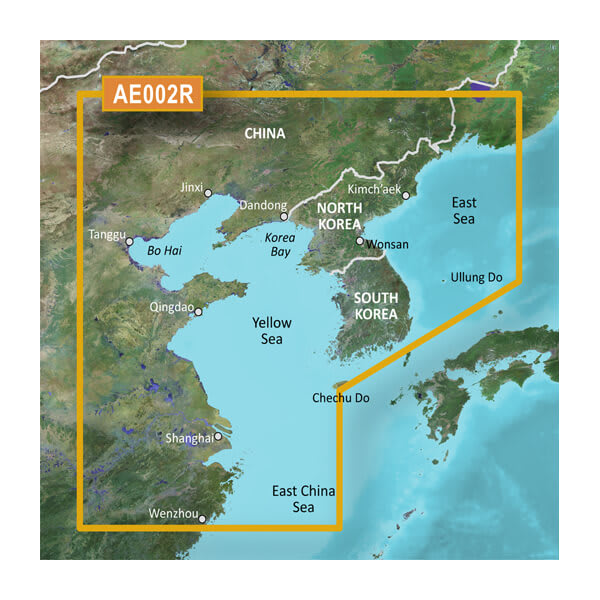
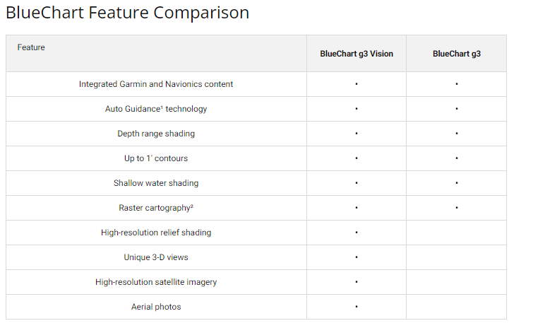
- Coverage spanning the entire South Korean coast, Yellow Sea, and East China Sea from Wenzhou to Dandong with official hydrographic source data
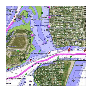
- Depth range shading displaying up to 10 distinct depth intervals for intuitive bottom composition interpretation
- 1-foot resolution bathymetric contours providing detailed bottom structure and submerged hazard identification
- Auto Guidance technology calculates vessel-optimized routes accounting for your boat's draft and dimensions
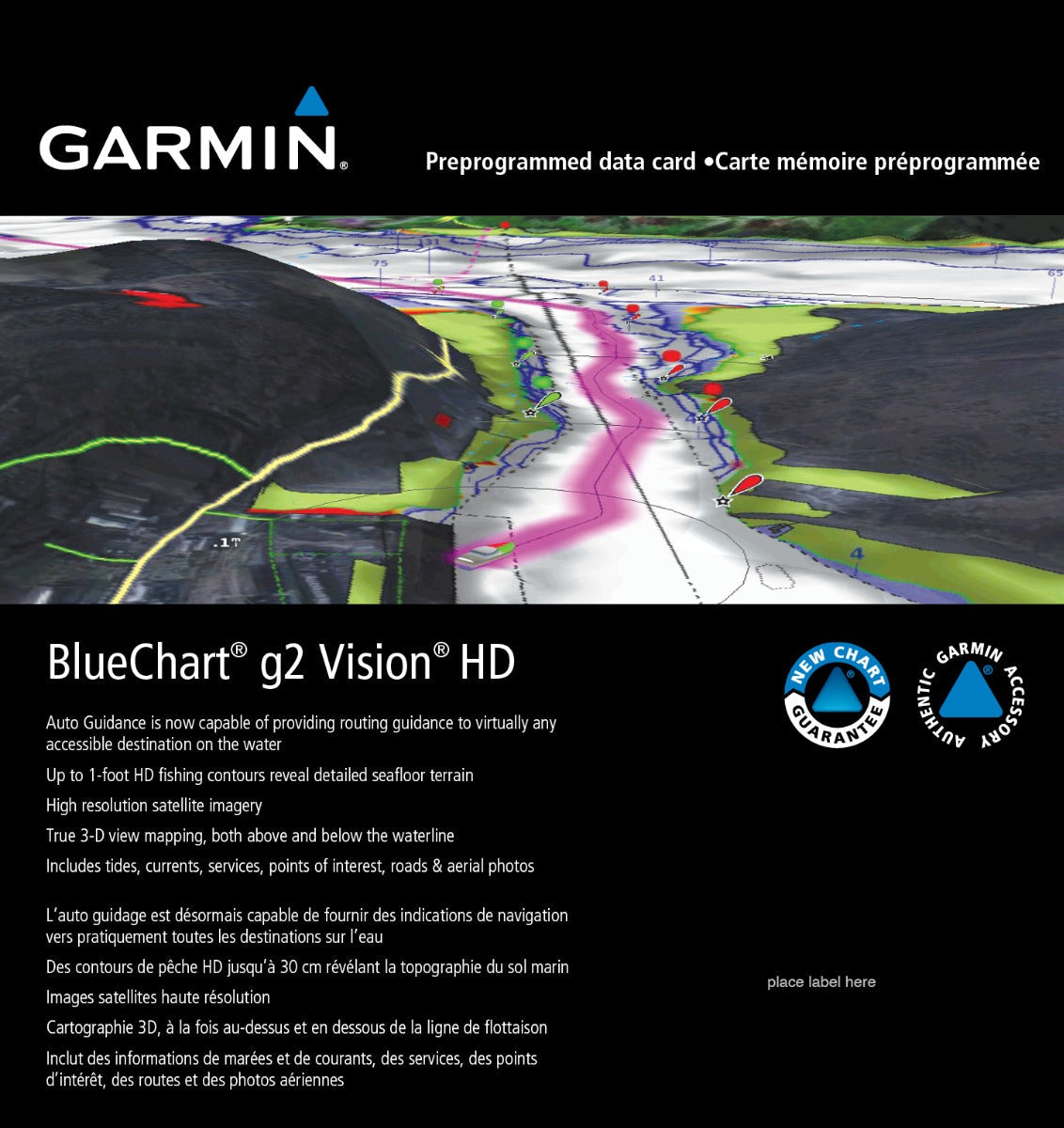
- Dual 3D viewing modes—MarinerEye above-water perspective and FishEye below-waterline visualization—for comprehensive spatial awareness
- High-resolution satellite imagery of ports, marinas, and navigational landmarks for visual landmark verification and anchorage identification
- Customizable shallow-water depth shading alerts for safe passage through unfamiliar or restricted-draft zones
- microSD/SD card format compatible with Garmin chartplotter units supporting BlueChart g3 Vision product line
Data Insights
Garmin's 1-foot contour technology improves positional accuracy by approximately 30% compared to standard 10-foot or coarser contour charts, a critical advantage in the Yellow Sea's shallow, shifting bottom conditions. The Auto Guidance route calculation engine reduces average transit time by up to 20% by accounting for vessel draft and optimizing waypoint placement around shallows and maritime traffic separation schemes. These performance gains directly translate to fuel efficiency, reduced grounding risk, and faster fishing location transit for commercial and recreational operators working these waters.
Usage Instructions
Insert the VAE002R microSD/SD card into your Garmin chartplotter's card slot and ensure the device recognizes the chart during startup. Activate Auto Guidance and input your vessel's beam, length, and draft specifications for accurate route suggestions. Enable the desired depth range shading and contour display settings in your chartplotter's chart preferences menu, then use MarinerEye or FishEye 3D views to preview upcoming coastal geometry. Periodically check Garmin's website for chart updates to maintain current data accuracy, particularly before seasonal fishing migrations or commercial operations.
Design & Material
The VAE002R chart card employs a compact microSD/SD form factor engineered for secure integration into Garmin's chartplotter ecosystem without adding bulk to your pilothouse setup. The card's protective casing shields the memory substrate from salt spray, humidity, and mechanical shock typical of extended marine operations.
- MicroSD/SD card format compatible with Garmin GPSMAP, ECHOMAP, and Panoptix-series chartplotters
- Robust memory substrate rated for marine-grade environmental conditions and temperature cycling
- Protective packaging designed to minimize electrostatic discharge and physical damage during storage and transport
- Lightweight portable profile—approximately 0.5 ounces—for easy backup chart card storage aboard vessel
- Integrated label graphics clearly identifying chart region and product model number for rapid identification
- Long-term data retention specification supporting archival backup and multi-season chart preservation
Final Verdict
Operators navigating the Yellow Sea and South Korean coastal waters cannot rely on generic worldwide charts designed for deeper ocean basins. The VAE002R BlueChart g3 Vision delivers region-specific bathymetric resolution and current satellite imagery that directly reduces navigation risk and operating time. Whether you're a commercial fishing captain, pleasure boater, or maritime professional, this chart card provides the specialized data accuracy and 3D perspective tools that transform your Garmin chartplotter from a basic positioning device into a precise shallow-water navigation system. Purchase the VAE002R today and navigate these complex waters with the confidence that comes from official-source hydrographic detail and advanced visualization technology.


