


Garmin Canada, P.E.I. to Chaleur Bay Coastal Charts BlueChart g3 Vision | VCA006R | microSD/SD (010-C0692-00)
Garmin Canada, P.E.I. to Chaleur Bay Coastal Charts BlueChart g3 Vision | VCA006R | microSD/SD (010-C0692-00)
Model Number: 010-C0692-00
In stock
 WhatsApp
 SMS - Text us!
 Email Us!
 Help Desk


Tech Specs
In The Box
Do you have an old GPS unit lying around? The GPS Nation Trade In and Up program is a great way to trade in your old and used GPS for credit towards a new GPS. The choice is entirely yours! We’ve made the process simple and streamlined. Follow these simple steps, and you will be on your way to receiving credit towards your brand new GPS!
1. Get a quote
To get your free quote, provide your GPS type, manufacturer, model, and condition. Within 24 hours, you will receive a quote for the trade-in value of your current product. The GPS trade-in/trade-up form is at the bottom of this page.
2. Ship your product(s) for trade
After accepting our offer, pack your product(s) safely and ship them to us using the pre-paid shipping label provided to you. We will provide a confirmation email when your trade-in arrives at our warehouse. You have 30 days from the date you complete your on-line trade to ship the product to GPS Nation.
3. Make your purchase
Once we receive your product at our warehouse and we validate the stated condition, we will send you a confirmation email. If you elect to receive credit towards a new GPS at gpsnation.com, your store credit will be issued, and you are free to make your purchase.
Manual & Warranty
 Garmin Warranty
Reviews
Ask a Question
Tech Specs
In The Box
Trade-In
Do you have an old GPS unit lying around? The GPS Nation Trade In and Up program is a great way to trade in your old and used GPS for credit towards a new GPS. The choice is entirely yours! We’ve made the process simple and streamlined. Follow these simple steps, and you will be on your way to receiving credit towards your brand new GPS!
1. Get a quote
To get your free quote, provide your GPS type, manufacturer, model, and condition. Within 24 hours, you will receive a quote for the trade-in value of your current product. The GPS trade-in/trade-up form is at the bottom of this page.
2. Ship your product(s) for trade
After accepting our offer, pack your product(s) safely and ship them to us using the pre-paid shipping label provided to you. We will provide a confirmation email when your trade-in arrives at our warehouse. You have 30 days from the date you complete your on-line trade to ship the product to GPS Nation.
3. Make your purchase
Once we receive your product at our warehouse and we validate the stated condition, we will send you a confirmation email. If you elect to receive credit towards a new GPS at gpsnation.com, your store credit will be issued, and you are free to make your purchase.
Manual & Warranty
Overview
Garmin Canada BlueChart g3 Vision: P.E.I. to Chaleur Bay Coastal Navigation Charts
Introduction
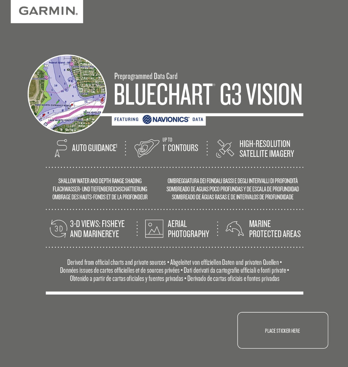
The Garmin Canada BlueChart g3 Vision delivers professional-grade coastal charting across Eastern Canadian waters, combining detailed bathymetry, satellite imagery, and automated route planning to enhance safety and navigation efficiency. Whether you're exploring the waters around Prince Edward Island, navigating through Chaleur Bay, or surveying the Gulf of St. Lawrence, this microSD/SD card brings integrated Garmin and Navionics data directly to your compatible marine GPS device.
Key Features
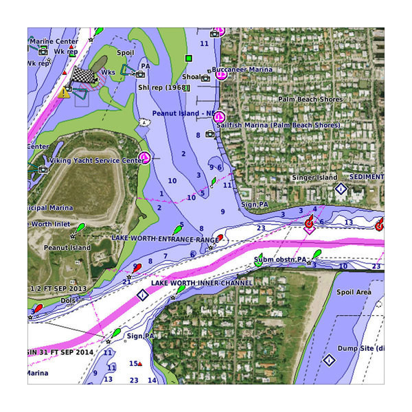
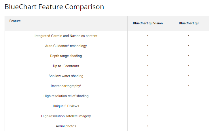
- Integrated depth contours mapped to 1-foot precision, revealing detailed underwater topography and structural features for enhanced fishing and navigation accuracy
- Depth range shading system supporting up to 10 distinct depth zones for color-coded water visualization and hazard identification
- Auto Guidance technology that calculates optimal routes based on your vessel's draft and desired overhead clearance requirements
- High-resolution satellite imagery overlaid with navigational chart data, providing realistic coastal reference alongside traditional charting information
- Shallow water shading with user-customizable depth thresholds to prevent grounding in unfamiliar coastal areas
- 3D underwater perspective rendering, enabling mariners to visualize seafloor topography and navigate with enhanced situational awareness
- MicroSD/SD card format (Model 010-C0692-00) compatible with all current Garmin chartplotter systems
Data Insights
The BlueChart g3 Vision coverage area spans from Prince Edward Island through the Gulf of St. Lawrence to Chaleur Bay, encompassing over 800 nautical miles of Canadian Atlantic coastline. The combination of 1-foot contour intervals with up to 10 depth-range shading categories provides mariners with the granular bathymetric detail necessary for both commercial and recreational navigation, while integrated 3D rendering delivers visual context that improves decision-making during dynamic water conditions.
Usage Instructions
Insert the microSD/SD card into your compatible Garmin device's card slot and allow the system to recognize and index the chart data. Access the charting software through your device's main menu, then activate Auto Guidance by inputting your vessel's maximum draft and overhead clearance preferences. Customize depth shading ranges to match local conditions, and consult the satellite imagery overlay when transitioning between charted and real-world landmarks.
Design & Material
This chart solution prioritizes reliability and ease of deployment in demanding marine environments. The microSD/SD format ensures compact storage without sacrificing comprehensive coverage, while the underlying architecture balances technical sophistication with straightforward user workflows.
- MicroSD/SD card media format enables compatibility with Garmin's entire modern chartplotter lineup and portable marine devices
- Durable digital construction resists degradation from salt spray, humidity, and temperature fluctuations common in coastal operations
- Dual-source content integration merges Garmin's proprietary data with Navionics charts, reducing coverage gaps and improving accuracy
- Weather-resistant design ensures consistent performance across fog, heavy rain, and variable sea states without data corruption
- Intuitive menu structure minimizes training time for operators transitioning from paper charts or legacy digital systems
- Compact physical form factor allows secure storage aboard vessels of any size and easy backup or transport between multiple devices
Final Verdict
The Garmin Canada BlueChart g3 Vision is an essential upgrade for anyone navigating Eastern Canadian coastal waters with frequency or confidence requirements. The combination of 1-foot contours, 10-layer depth shading, Auto Guidance automation, and integrated satellite reference eliminates guesswork and reduces navigation risk in complex tide zones and shallow-draft areas. For fishermen, cruising mariners, and commercial operators alike, this chart card delivers the situational clarity and route intelligence required for safe, efficient passage. Order your BlueChart g3 Vision card today and transform your navigation confidence across P.E.I., Chaleur Bay, and the Gulf of St. Lawrence.


