


 WhatsApp
 SMS - Text us!
 Email Us!
 Help Desk
- GPSMAP 7612 with worldwide basemap preloaded with U.S. BlueChart® g2 and U.S. LakeVü™ HD
- Power/data cable
- NMEA 2000® drop cable
- T-connector
- Bail mount with knobs
- Flush mount kit
- Protective cover
- Grommet
- Documentation
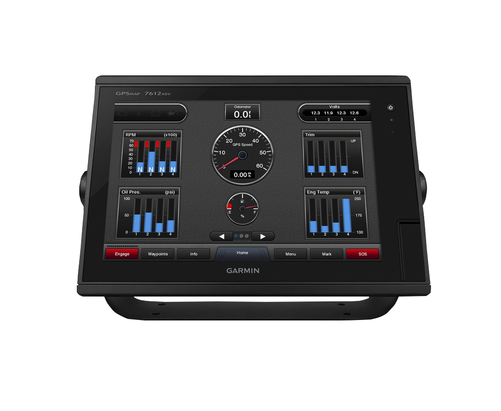
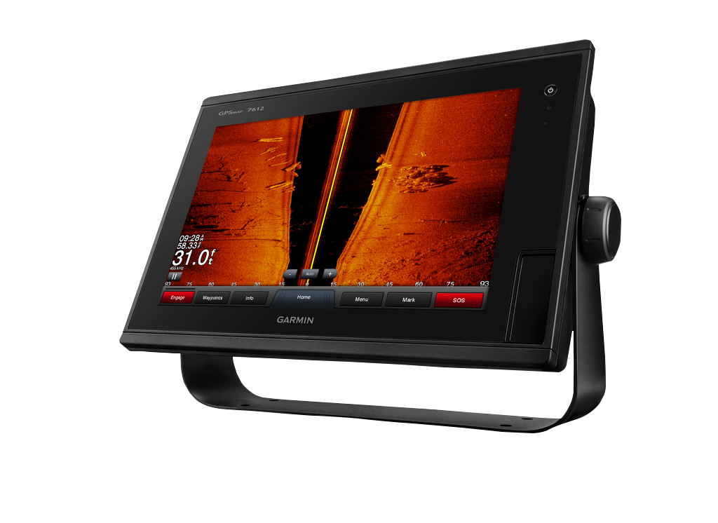
Garmin GPSMAP 7612 (010-01307-01)
Garmin GPSMAP 7612 (010-01307-01)
Model Number: 010-01307-01
Out of stock
Condition:
New
A brand new Garmin device. This Garmin GPSMAP 7612 (010-01307-01) is retail packaged and factory sealed from Garmin USA. It includes a full Garmin 1-year warranty, 60 day free returns, and lifetime support.
Regular price
$4,164.99
Sale price
$4,164.99
Regular price
Unit price
per

Tech Specs
Garmin GPSMAP 7612 Marine Chartplotter with 10 Hz GPS and 12-Inch Touch Display
Introduction
The Garmin GPSMAP 7612 delivers real-time marine navigation with a 10 Hz GPS update rate that refreshes your position 10 times per second, providing position accuracy within 10 meters or less. Built for cruisers, racing sailors, and serious anglers, this 12-inch multi-touch chartplotter integrates preloaded mapping, NMEA 2000 network connectivity, and Auto Guidance Technology into a single integrated platform that simplifies route planning and improves situational awareness on the water.
Key Features
- 12-inch multi-touch widescreen display with high-resolution clarity in daylight and low-light conditions
- 10 Hz internal GPS providing position updates 10 times per second for improved tracking and accuracy
- Preloaded BlueChart g2 Maps with comprehensive nautical charts and smooth digital zoom transitions
- Preloaded LakeVü HD Maps covering over 17,000 U.S. lakes with 1-foot contour intervals
- NMEA 2000 full-network compatibility supporting radar, autopilot, and additional Garmin marine devices
- Built-in Wi-Fi connectivity for synchronization with Garmin Helm mobile app and BlueChart Mobile updates
- Auto Guidance Technology that automatically calculates safe, efficient routes to your destination
- Switchable 2-D and 3-D view modes for flexible navigation visualization
Data Insights
The 10 Hz update frequency on the GPSMAP 7612 delivers position accuracy within 10 meters or less, a significant improvement over standard 1 Hz systems that refresh only once per second. This faster refresh rate is especially valuable when navigating narrow channels, docking, or fishing in precision-sensitive waters. The integration of over 17,000 pre-mapped U.S. lakes with detailed 1-foot bathymetric contours provides the level of depth detail needed for both navigation safety and fishing-specific applications like structure identification.
Usage Instructions
Install the GPSMAP 7612 securely to your vessel's helm, then power on and complete the on-screen setup wizard. Use the intuitive touchscreen to browse your preloaded charts, mark waypoints, and enter your destination. Activate Auto Guidance Technology to receive an optimized route that avoids shallow water and navigational hazards. Toggle between 2-D chart view and 3-D perspective to match your navigation preference, and use the dedicated menu buttons to access sonar, waypoint data, and network settings without interrupting your primary view.
Design & Material
The GPSMAP 7612 combines a compact profile with a robust architecture designed specifically for marine environments. Its modern display and ergonomic button layout integrate seamlessly on center consoles, pilot houses, or pilothouse enclosures without consuming excessive dash space. The entire unit is engineered to deliver reliable performance in salt spray, intense sunlight, and rough water conditions.
- Marine-grade construction materials resistant to corrosion and salt-water exposure
- Weather-resistant design rated for open-water operation in all standard marine conditions
- Multi-touch display with anti-glare coating for visibility across a wide range of lighting conditions
- Integrated mounting bracket system accommodates standard flush or rail-mount installation
- Ergonomic side-mounted knobs and tactile button controls for operation with gloved hands
- Reinforced bezel and frame construction to withstand vibration and mechanical shock from rough seas
Final Verdict
The Garmin GPSMAP 7612 is a serious navigation tool for anyone who demands precision, reliability, and fast decision-making on the water. Whether you're plotting a 100-mile offshore passage, navigating a complex estuary, or targeting specific structure on your favorite lake, the combination of 10 Hz GPS accuracy, detailed preloaded maps, and network expansion capability gives you a complete navigation ecosystem without the need for separate devices. This is essential equipment for professional captains, dedicated cruisers, and competitive anglers. Invest in the GPSMAP 7612 and gain the confidence that comes with proven marine technology.
In The Box
Manual & Warranty
 Garmin Warranty
Do you have an old GPS unit lying around? The GPS Nation Trade In and Up program is a great way to trade in your old and used GPS for credit towards a new GPS. The choice is entirely yours! We’ve made the process simple and streamlined. Follow these simple steps, and you will be on your way to receiving credit towards your brand new GPS!
1. Get a quote
To get your free quote, provide your GPS type, manufacturer, model, and condition. Within 24 hours, you will receive a quote for the trade-in value of your current product. The GPS trade-in/trade-up form is at the bottom of this page.
2. Ship your product(s) for trade
After accepting our offer, pack your product(s) safely and ship them to us using the pre-paid shipping label provided to you. We will provide a confirmation email when your trade-in arrives at our warehouse. You have 30 days from the date you complete your on-line trade to ship the product to GPS Nation.
3. Make your purchase
Once we receive your product at our warehouse and we validate the stated condition, we will send you a confirmation email. If you elect to receive credit towards a new GPS at gpsnation.com, your store credit will be issued, and you are free to make your purchase.
Reviews
Ask a Question
Tech Specs
Garmin GPSMAP 7612 Marine Chartplotter with 10 Hz GPS and 12-Inch Touch Display
Introduction
The Garmin GPSMAP 7612 delivers real-time marine navigation with a 10 Hz GPS update rate that refreshes your position 10 times per second, providing position accuracy within 10 meters or less. Built for cruisers, racing sailors, and serious anglers, this 12-inch multi-touch chartplotter integrates preloaded mapping, NMEA 2000 network connectivity, and Auto Guidance Technology into a single integrated platform that simplifies route planning and improves situational awareness on the water.
Key Features
- 12-inch multi-touch widescreen display with high-resolution clarity in daylight and low-light conditions
- 10 Hz internal GPS providing position updates 10 times per second for improved tracking and accuracy
- Preloaded BlueChart g2 Maps with comprehensive nautical charts and smooth digital zoom transitions
- Preloaded LakeVü HD Maps covering over 17,000 U.S. lakes with 1-foot contour intervals
- NMEA 2000 full-network compatibility supporting radar, autopilot, and additional Garmin marine devices
- Built-in Wi-Fi connectivity for synchronization with Garmin Helm mobile app and BlueChart Mobile updates
- Auto Guidance Technology that automatically calculates safe, efficient routes to your destination
- Switchable 2-D and 3-D view modes for flexible navigation visualization
Data Insights
The 10 Hz update frequency on the GPSMAP 7612 delivers position accuracy within 10 meters or less, a significant improvement over standard 1 Hz systems that refresh only once per second. This faster refresh rate is especially valuable when navigating narrow channels, docking, or fishing in precision-sensitive waters. The integration of over 17,000 pre-mapped U.S. lakes with detailed 1-foot bathymetric contours provides the level of depth detail needed for both navigation safety and fishing-specific applications like structure identification.
Usage Instructions
Install the GPSMAP 7612 securely to your vessel's helm, then power on and complete the on-screen setup wizard. Use the intuitive touchscreen to browse your preloaded charts, mark waypoints, and enter your destination. Activate Auto Guidance Technology to receive an optimized route that avoids shallow water and navigational hazards. Toggle between 2-D chart view and 3-D perspective to match your navigation preference, and use the dedicated menu buttons to access sonar, waypoint data, and network settings without interrupting your primary view.
Design & Material
The GPSMAP 7612 combines a compact profile with a robust architecture designed specifically for marine environments. Its modern display and ergonomic button layout integrate seamlessly on center consoles, pilot houses, or pilothouse enclosures without consuming excessive dash space. The entire unit is engineered to deliver reliable performance in salt spray, intense sunlight, and rough water conditions.
- Marine-grade construction materials resistant to corrosion and salt-water exposure
- Weather-resistant design rated for open-water operation in all standard marine conditions
- Multi-touch display with anti-glare coating for visibility across a wide range of lighting conditions
- Integrated mounting bracket system accommodates standard flush or rail-mount installation
- Ergonomic side-mounted knobs and tactile button controls for operation with gloved hands
- Reinforced bezel and frame construction to withstand vibration and mechanical shock from rough seas
Final Verdict
The Garmin GPSMAP 7612 is a serious navigation tool for anyone who demands precision, reliability, and fast decision-making on the water. Whether you're plotting a 100-mile offshore passage, navigating a complex estuary, or targeting specific structure on your favorite lake, the combination of 10 Hz GPS accuracy, detailed preloaded maps, and network expansion capability gives you a complete navigation ecosystem without the need for separate devices. This is essential equipment for professional captains, dedicated cruisers, and competitive anglers. Invest in the GPSMAP 7612 and gain the confidence that comes with proven marine technology.
In The Box
- GPSMAP 7612 with worldwide basemap preloaded with U.S. BlueChart® g2 and U.S. LakeVü™ HD
- Power/data cable
- NMEA 2000® drop cable
- T-connector
- Bail mount with knobs
- Flush mount kit
- Protective cover
- Grommet
- Documentation
Manual & Warranty
Trade-In
Do you have an old GPS unit lying around? The GPS Nation Trade In and Up program is a great way to trade in your old and used GPS for credit towards a new GPS. The choice is entirely yours! We’ve made the process simple and streamlined. Follow these simple steps, and you will be on your way to receiving credit towards your brand new GPS!
1. Get a quote
To get your free quote, provide your GPS type, manufacturer, model, and condition. Within 24 hours, you will receive a quote for the trade-in value of your current product. The GPS trade-in/trade-up form is at the bottom of this page.
2. Ship your product(s) for trade
After accepting our offer, pack your product(s) safely and ship them to us using the pre-paid shipping label provided to you. We will provide a confirmation email when your trade-in arrives at our warehouse. You have 30 days from the date you complete your on-line trade to ship the product to GPS Nation.
3. Make your purchase
Once we receive your product at our warehouse and we validate the stated condition, we will send you a confirmation email. If you elect to receive credit towards a new GPS at gpsnation.com, your store credit will be issued, and you are free to make your purchase.
Overview
Garmin GPSMAP 7612 Marine Chartplotter with 10 Hz GPS and 12-Inch Touch Display
Introduction
The Garmin GPSMAP 7612 delivers real-time marine navigation with a 10 Hz GPS update rate that refreshes your position 10 times per second, providing position accuracy within 10 meters or less. Built for cruisers, racing sailors, and serious anglers, this 12-inch multi-touch chartplotter integrates preloaded mapping, NMEA 2000 network connectivity, and Auto Guidance Technology into a single integrated platform that simplifies route planning and improves situational awareness on the water.
Key Features
- 12-inch multi-touch widescreen display with high-resolution clarity in daylight and low-light conditions
- 10 Hz internal GPS providing position updates 10 times per second for improved tracking and accuracy
- Preloaded BlueChart g2 Maps with comprehensive nautical charts and smooth digital zoom transitions
- Preloaded LakeVü HD Maps covering over 17,000 U.S. lakes with 1-foot contour intervals
- NMEA 2000 full-network compatibility supporting radar, autopilot, and additional Garmin marine devices
- Built-in Wi-Fi connectivity for synchronization with Garmin Helm mobile app and BlueChart Mobile updates
- Auto Guidance Technology that automatically calculates safe, efficient routes to your destination
- Switchable 2-D and 3-D view modes for flexible navigation visualization
Data Insights
The 10 Hz update frequency on the GPSMAP 7612 delivers position accuracy within 10 meters or less, a significant improvement over standard 1 Hz systems that refresh only once per second. This faster refresh rate is especially valuable when navigating narrow channels, docking, or fishing in precision-sensitive waters. The integration of over 17,000 pre-mapped U.S. lakes with detailed 1-foot bathymetric contours provides the level of depth detail needed for both navigation safety and fishing-specific applications like structure identification.
Usage Instructions
Install the GPSMAP 7612 securely to your vessel's helm, then power on and complete the on-screen setup wizard. Use the intuitive touchscreen to browse your preloaded charts, mark waypoints, and enter your destination. Activate Auto Guidance Technology to receive an optimized route that avoids shallow water and navigational hazards. Toggle between 2-D chart view and 3-D perspective to match your navigation preference, and use the dedicated menu buttons to access sonar, waypoint data, and network settings without interrupting your primary view.
Design & Material
The GPSMAP 7612 combines a compact profile with a robust architecture designed specifically for marine environments. Its modern display and ergonomic button layout integrate seamlessly on center consoles, pilot houses, or pilothouse enclosures without consuming excessive dash space. The entire unit is engineered to deliver reliable performance in salt spray, intense sunlight, and rough water conditions.
- Marine-grade construction materials resistant to corrosion and salt-water exposure
- Weather-resistant design rated for open-water operation in all standard marine conditions
- Multi-touch display with anti-glare coating for visibility across a wide range of lighting conditions
- Integrated mounting bracket system accommodates standard flush or rail-mount installation
- Ergonomic side-mounted knobs and tactile button controls for operation with gloved hands
- Reinforced bezel and frame construction to withstand vibration and mechanical shock from rough seas
Final Verdict
The Garmin GPSMAP 7612 is a serious navigation tool for anyone who demands precision, reliability, and fast decision-making on the water. Whether you're plotting a 100-mile offshore passage, navigating a complex estuary, or targeting specific structure on your favorite lake, the combination of 10 Hz GPS accuracy, detailed preloaded maps, and network expansion capability gives you a complete navigation ecosystem without the need for separate devices. This is essential equipment for professional captains, dedicated cruisers, and competitive anglers. Invest in the GPSMAP 7612 and gain the confidence that comes with proven marine technology.


