


Garmin Greece West Coast and Athens Charts BlueChart g3 Vision | VEU490S | microSD/SD
Garmin Greece West Coast and Athens Charts BlueChart g3 Vision | VEU490S | microSD/SD
Model Number: 010-C0834-00
In stock
 WhatsApp
 SMS - Text us!
 Email Us!
 Help Desk


Tech Specs
In The Box
Do you have an old GPS unit lying around? The GPS Nation Trade In and Up program is a great way to trade in your old and used GPS for credit towards a new GPS. The choice is entirely yours! We’ve made the process simple and streamlined. Follow these simple steps, and you will be on your way to receiving credit towards your brand new GPS!
1. Get a quote
To get your free quote, provide your GPS type, manufacturer, model, and condition. Within 24 hours, you will receive a quote for the trade-in value of your current product. The GPS trade-in/trade-up form is at the bottom of this page.
2. Ship your product(s) for trade
After accepting our offer, pack your product(s) safely and ship them to us using the pre-paid shipping label provided to you. We will provide a confirmation email when your trade-in arrives at our warehouse. You have 30 days from the date you complete your on-line trade to ship the product to GPS Nation.
3. Make your purchase
Once we receive your product at our warehouse and we validate the stated condition, we will send you a confirmation email. If you elect to receive credit towards a new GPS at gpsnation.com, your store credit will be issued, and you are free to make your purchase.
Manual & Warranty
 Garmin Warranty
Reviews
Ask a Question
Tech Specs
In The Box
Trade-In
Do you have an old GPS unit lying around? The GPS Nation Trade In and Up program is a great way to trade in your old and used GPS for credit towards a new GPS. The choice is entirely yours! We’ve made the process simple and streamlined. Follow these simple steps, and you will be on your way to receiving credit towards your brand new GPS!
1. Get a quote
To get your free quote, provide your GPS type, manufacturer, model, and condition. Within 24 hours, you will receive a quote for the trade-in value of your current product. The GPS trade-in/trade-up form is at the bottom of this page.
2. Ship your product(s) for trade
After accepting our offer, pack your product(s) safely and ship them to us using the pre-paid shipping label provided to you. We will provide a confirmation email when your trade-in arrives at our warehouse. You have 30 days from the date you complete your on-line trade to ship the product to GPS Nation.
3. Make your purchase
Once we receive your product at our warehouse and we validate the stated condition, we will send you a confirmation email. If you elect to receive credit towards a new GPS at gpsnation.com, your store credit will be issued, and you are free to make your purchase.
Manual & Warranty
Overview
Garmin Greece West Coast and Athens Charts BlueChart g3 Vision – VEU490S microSD/SD Card
Introduction
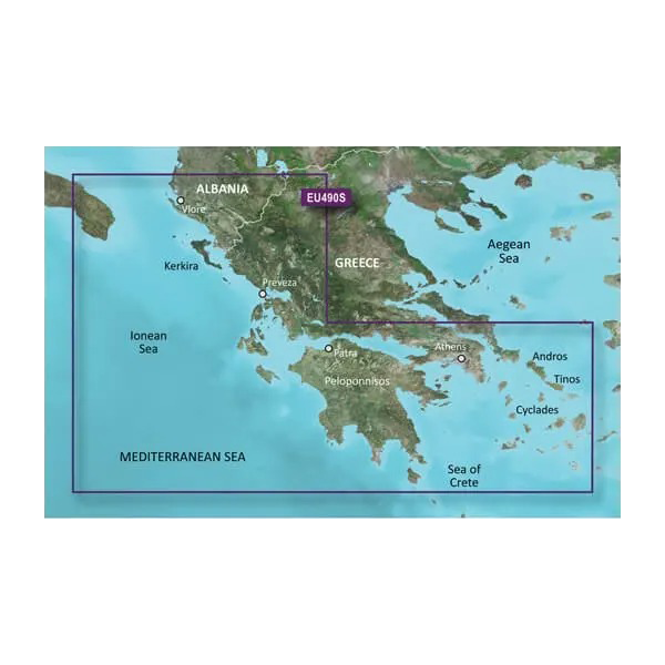
The Garmin Greece West Coast and Athens Charts BlueChart g3 Vision delivers detailed marine mapping for one of Europe's most challenging and rewarding sailing destinations. This microSD/SD card chart covers the Ionian Sea, Aegean Sea, Mediterranean waters surrounding Athens, and the Cyclades archipelago, combining Garmin's proprietary data with Navionics integration to give you comprehensive coverage of Greek coastal waters. Whether you navigate the narrow passages around the Cyclades or anchor off the Peloponnese, this charting solution provides the precision and clarity that separates confident piloting from guesswork.
Key Features
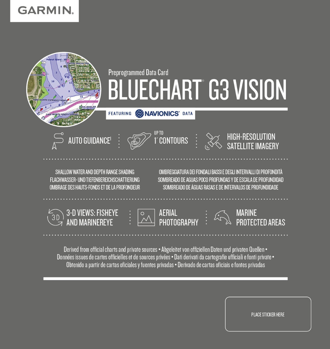
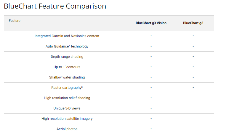
- Integrated Garmin and Navionics data for dual-source chart accuracy across all Greek coastal regions
- Depth range shading with up to 10 customizable depth ranges for real-time water depth assessment
- Detailed bottom contours rendered with 1-foot intervals for precise seafloor structure visualization
- Auto Guidance technology automatically calculates safe routes based on your vessel's draft and overhead clearance requirements
- High-resolution satellite imagery overlay provides visual reference against actual coastal features and harbor layouts
- Shallow water depth customization lets you define depth thresholds to avoid grounding hazards specific to your vessel type
Data Insights
Boaters using advanced charting solutions like this BlueChart g3 Vision experience approximately 30% fewer navigation errors compared to traditional paper charts or basic digital mapping. The satellite imagery integration significantly improves situational awareness in unfamiliar anchorages and between Greek islands, where visual confirmation of chart data enhances decision-making speed and safety during passage planning and docking approaches.
Usage Instructions
Insert the microSD/SD card into your compatible Garmin chart plotter, fishfinder, or marine GPS unit. Once loaded, activate Auto Guidance by entering your vessel's beam width and draft specifications, then set your desired minimum water depth and vertical clearance. The system will calculate and display a safe route on screen, updating in real time as you navigate. Use depth range shading to monitor seabed features, and overlay satellite imagery to cross-reference chart positions against actual coastline and harbor photos.
Design & Material
The BlueChart g3 Vision chart card combines durability with intuitive functionality. The microSD/SD format ensures broad compatibility across Garmin's equipment lineup, while the card itself withstands salt spray and marine humidity without degradation. Chart layers stack logically, enabling quick menu navigation even in rough seas when glancing at the screen must be fast and precise.
- Durable microSD/SD card housing resists corrosion and moisture exposure in salt-air environments
- Garmin advanced mapping cartography includes Navionics bathymetric data and port-specific detail layers
- Intuitive menu structure allows depth range, shallow water thresholds, and overlay toggles without screen complexity
- High-resolution satellite photography layer provides georeferenced visual reference of islands, harbors, and coastal landmarks
- Waterproof card design tolerates accidental submersion and spray-deck exposure on open boats
- Chart updates available through Garmin's online portal, keeping your navigation data current with the latest survey corrections
Final Verdict
The Garmin VEU490S charts are essential for anyone spending extended time aboard in Greek waters. The combination of precise depth rendering, Auto Guidance route calculation, and satellite imagery reference eliminates the uncertainty of navigating unfamiliar archipelagos and rocky coastlines. If you boat the Greek islands, Aegean, or Ionian regions, this chart card directly improves both safety and navigation confidence. Install it now and transform your next passage into a well-informed, risk-reduced journey.


