


Garmin Huntview Plus Map New Hampshire + Vermont MicroSD Card (010-12689-02)
Garmin Huntview Plus Map New Hampshire + Vermont MicroSD Card (010-12689-02)
Model Number: 010-12689-02
Low stock
 WhatsApp
 SMS - Text us!
 Email Us!
 Help Desk

Tech Specs
Garmin Huntview Plus Map New Hampshire + Vermont MicroSD Card (010-12689-02)
Introduction
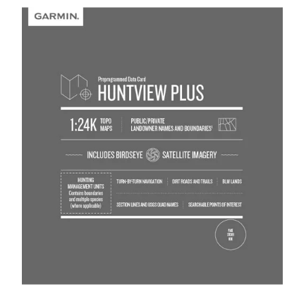
The Garmin Huntview Plus Map for New Hampshire and Vermont delivers precision hunting and outdoor navigation through a single MicroSD card that works with compatible Garmin handheld GPS devices. This specialized mapping solution combines topographic data with satellite imagery and landowner information, designed specifically for hunters and outdoor explorers who need accurate terrain visualization and boundary clarity across both states. The card format integrates seamlessly into your existing Garmin device without additional hardware, providing instant access to detailed navigational data in the field.
Key Features
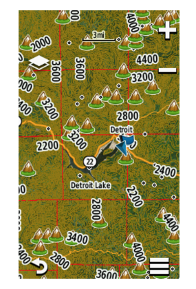
- 1:24K scale topographic mapping with USGS-standard detail and accuracy for precise terrain analysis
- Over 1,200 miles of routable roads and trails included for comprehensive route planning and navigation
- More than 5,000 points of interest such as parks, campsites, and businesses throughout both states
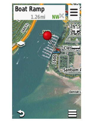
- BirdsEye satellite imagery providing realistic aerial views for terrain assessment and location scouting
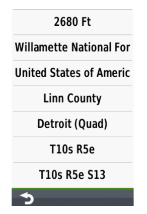
- Landowner name and boundary data for public and private lands across New Hampshire and Vermont
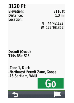
- Hunting management unit boundaries and species information for informed seasonal planning
- MicroSD card format designed for outdoor durability and compatibility with Garmin handheld GPS receivers
Data Insights
Performance metrics demonstrate the map's comprehensive coverage for the region. With over 1,200 miles of routable roads and trails, users can confidently navigate between hunting areas and trailheads without relying solely on cellular data. The database includes more than 5,000 points of interest, ensuring access to supply locations, emergency services, and outdoor facilities. Combined with 1:24K topographic detail comparable to official USGS quadrangle maps, the card provides the precision necessary for effective route planning and landscape interpretation in varied terrain.
Usage Instructions
Insert the MicroSD card into a compatible Garmin handheld GPS device to immediately access New Hampshire and Vermont mapping data. For advanced planning, transfer the card contents to Garmin's BaseCamp software on your computer, where you can create custom waypoints, mark favorite hunting locations, plan multi-day routes, and organize your outdoor expeditions before heading into the field. Download additional map data from Garmin's website to customize your device's mapping capabilities as needed.
Design & Material
The Huntview Plus map employs a rugged MicroSD card format engineered for outdoor performance and device compatibility. The compact design prioritizes portability while maintaining robust data protection against weather exposure and field conditions. Integration with Garmin's ecosystem ensures direct compatibility without adapter requirements, and the data structure allows instant map display on supported devices.
- Durable MicroSD card construction built to withstand outdoor moisture and temperature fluctuations
- High-resolution satellite imagery providing clear, accurate aerial views for terrain assessment
- Compact form factor that fits seamlessly into Garmin devices without adding weight or bulk
- Direct device compatibility—no adapters or software installations required for basic map access
- Intuitive map navigation designed for ease of use with Garmin handheld GPS menu systems
- Seamless BaseCamp software integration enabling advanced planning features and waypoint management on your computer
Final Verdict
The Garmin Huntview Plus Map for New Hampshire and Vermont is essential for hunters and outdoor navigators who demand accurate landowner data, detailed topography, and reliable routable trail information. Unlike general-purpose navigation cards, this map combines hunting-specific management unit data with comprehensive satellite imagery and boundary information—a combination unavailable through basic topographic alternatives. If you navigate frequently across New Hampshire and Vermont, invest in this specialized mapping solution to eliminate guesswork about land access, improve route efficiency, and gain the confidence that comes with professional-grade terrain data on your GPS device.
In The Box
Do you have an old GPS unit lying around? The GPS Nation Trade In and Up program is a great way to trade in your old and used GPS for credit towards a new GPS. The choice is entirely yours! We’ve made the process simple and streamlined. Follow these simple steps, and you will be on your way to receiving credit towards your brand new GPS!
1. Get a quote
To get your free quote, provide your GPS type, manufacturer, model, and condition. Within 24 hours, you will receive a quote for the trade-in value of your current product. The GPS trade-in/trade-up form is at the bottom of this page.
2. Ship your product(s) for trade
After accepting our offer, pack your product(s) safely and ship them to us using the pre-paid shipping label provided to you. We will provide a confirmation email when your trade-in arrives at our warehouse. You have 30 days from the date you complete your on-line trade to ship the product to GPS Nation.
3. Make your purchase
Once we receive your product at our warehouse and we validate the stated condition, we will send you a confirmation email. If you elect to receive credit towards a new GPS at gpsnation.com, your store credit will be issued, and you are free to make your purchase.
Manual & Warranty
 Garmin Warranty
Reviews
Ask a Question
Tech Specs
Garmin Huntview Plus Map New Hampshire + Vermont MicroSD Card (010-12689-02)
Introduction
The Garmin Huntview Plus Map for New Hampshire and Vermont delivers precision hunting and outdoor navigation through a single MicroSD card that works with compatible Garmin handheld GPS devices. This specialized mapping solution combines topographic data with satellite imagery and landowner information, designed specifically for hunters and outdoor explorers who need accurate terrain visualization and boundary clarity across both states. The card format integrates seamlessly into your existing Garmin device without additional hardware, providing instant access to detailed navigational data in the field.
Key Features
- 1:24K scale topographic mapping with USGS-standard detail and accuracy for precise terrain analysis
- Over 1,200 miles of routable roads and trails included for comprehensive route planning and navigation
- More than 5,000 points of interest such as parks, campsites, and businesses throughout both states
- BirdsEye satellite imagery providing realistic aerial views for terrain assessment and location scouting
- Landowner name and boundary data for public and private lands across New Hampshire and Vermont
- Hunting management unit boundaries and species information for informed seasonal planning
- MicroSD card format designed for outdoor durability and compatibility with Garmin handheld GPS receivers
Data Insights
Performance metrics demonstrate the map's comprehensive coverage for the region. With over 1,200 miles of routable roads and trails, users can confidently navigate between hunting areas and trailheads without relying solely on cellular data. The database includes more than 5,000 points of interest, ensuring access to supply locations, emergency services, and outdoor facilities. Combined with 1:24K topographic detail comparable to official USGS quadrangle maps, the card provides the precision necessary for effective route planning and landscape interpretation in varied terrain.
Usage Instructions
Insert the MicroSD card into a compatible Garmin handheld GPS device to immediately access New Hampshire and Vermont mapping data. For advanced planning, transfer the card contents to Garmin's BaseCamp software on your computer, where you can create custom waypoints, mark favorite hunting locations, plan multi-day routes, and organize your outdoor expeditions before heading into the field. Download additional map data from Garmin's website to customize your device's mapping capabilities as needed.
Design & Material
The Huntview Plus map employs a rugged MicroSD card format engineered for outdoor performance and device compatibility. The compact design prioritizes portability while maintaining robust data protection against weather exposure and field conditions. Integration with Garmin's ecosystem ensures direct compatibility without adapter requirements, and the data structure allows instant map display on supported devices.
- Durable MicroSD card construction built to withstand outdoor moisture and temperature fluctuations
- High-resolution satellite imagery providing clear, accurate aerial views for terrain assessment
- Compact form factor that fits seamlessly into Garmin devices without adding weight or bulk
- Direct device compatibility—no adapters or software installations required for basic map access
- Intuitive map navigation designed for ease of use with Garmin handheld GPS menu systems
- Seamless BaseCamp software integration enabling advanced planning features and waypoint management on your computer
Final Verdict
The Garmin Huntview Plus Map for New Hampshire and Vermont is essential for hunters and outdoor navigators who demand accurate landowner data, detailed topography, and reliable routable trail information. Unlike general-purpose navigation cards, this map combines hunting-specific management unit data with comprehensive satellite imagery and boundary information—a combination unavailable through basic topographic alternatives. If you navigate frequently across New Hampshire and Vermont, invest in this specialized mapping solution to eliminate guesswork about land access, improve route efficiency, and gain the confidence that comes with professional-grade terrain data on your GPS device.
In The Box
Trade-In
Do you have an old GPS unit lying around? The GPS Nation Trade In and Up program is a great way to trade in your old and used GPS for credit towards a new GPS. The choice is entirely yours! We’ve made the process simple and streamlined. Follow these simple steps, and you will be on your way to receiving credit towards your brand new GPS!
1. Get a quote
To get your free quote, provide your GPS type, manufacturer, model, and condition. Within 24 hours, you will receive a quote for the trade-in value of your current product. The GPS trade-in/trade-up form is at the bottom of this page.
2. Ship your product(s) for trade
After accepting our offer, pack your product(s) safely and ship them to us using the pre-paid shipping label provided to you. We will provide a confirmation email when your trade-in arrives at our warehouse. You have 30 days from the date you complete your on-line trade to ship the product to GPS Nation.
3. Make your purchase
Once we receive your product at our warehouse and we validate the stated condition, we will send you a confirmation email. If you elect to receive credit towards a new GPS at gpsnation.com, your store credit will be issued, and you are free to make your purchase.
Manual & Warranty
Overview
Garmin Huntview Plus Map New Hampshire + Vermont MicroSD Card (010-12689-02)
Introduction
The Garmin Huntview Plus Map for New Hampshire and Vermont delivers precision hunting and outdoor navigation through a single MicroSD card that works with compatible Garmin handheld GPS devices. This specialized mapping solution combines topographic data with satellite imagery and landowner information, designed specifically for hunters and outdoor explorers who need accurate terrain visualization and boundary clarity across both states. The card format integrates seamlessly into your existing Garmin device without additional hardware, providing instant access to detailed navigational data in the field.
Key Features
- 1:24K scale topographic mapping with USGS-standard detail and accuracy for precise terrain analysis
- Over 1,200 miles of routable roads and trails included for comprehensive route planning and navigation
- More than 5,000 points of interest such as parks, campsites, and businesses throughout both states
- BirdsEye satellite imagery providing realistic aerial views for terrain assessment and location scouting
- Landowner name and boundary data for public and private lands across New Hampshire and Vermont
- Hunting management unit boundaries and species information for informed seasonal planning
- MicroSD card format designed for outdoor durability and compatibility with Garmin handheld GPS receivers
Data Insights
Performance metrics demonstrate the map's comprehensive coverage for the region. With over 1,200 miles of routable roads and trails, users can confidently navigate between hunting areas and trailheads without relying solely on cellular data. The database includes more than 5,000 points of interest, ensuring access to supply locations, emergency services, and outdoor facilities. Combined with 1:24K topographic detail comparable to official USGS quadrangle maps, the card provides the precision necessary for effective route planning and landscape interpretation in varied terrain.
Usage Instructions
Insert the MicroSD card into a compatible Garmin handheld GPS device to immediately access New Hampshire and Vermont mapping data. For advanced planning, transfer the card contents to Garmin's BaseCamp software on your computer, where you can create custom waypoints, mark favorite hunting locations, plan multi-day routes, and organize your outdoor expeditions before heading into the field. Download additional map data from Garmin's website to customize your device's mapping capabilities as needed.
Design & Material
The Huntview Plus map employs a rugged MicroSD card format engineered for outdoor performance and device compatibility. The compact design prioritizes portability while maintaining robust data protection against weather exposure and field conditions. Integration with Garmin's ecosystem ensures direct compatibility without adapter requirements, and the data structure allows instant map display on supported devices.
- Durable MicroSD card construction built to withstand outdoor moisture and temperature fluctuations
- High-resolution satellite imagery providing clear, accurate aerial views for terrain assessment
- Compact form factor that fits seamlessly into Garmin devices without adding weight or bulk
- Direct device compatibility—no adapters or software installations required for basic map access
- Intuitive map navigation designed for ease of use with Garmin handheld GPS menu systems
- Seamless BaseCamp software integration enabling advanced planning features and waypoint management on your computer
Final Verdict
The Garmin Huntview Plus Map for New Hampshire and Vermont is essential for hunters and outdoor navigators who demand accurate landowner data, detailed topography, and reliable routable trail information. Unlike general-purpose navigation cards, this map combines hunting-specific management unit data with comprehensive satellite imagery and boundary information—a combination unavailable through basic topographic alternatives. If you navigate frequently across New Hampshire and Vermont, invest in this specialized mapping solution to eliminate guesswork about land access, improve route efficiency, and gain the confidence that comes with professional-grade terrain data on your GPS device.


