


Garmin Huntview Plus Map Wyoming MicroSD Card (010-12258-03)
Garmin Huntview Plus Map Wyoming MicroSD Card (010-12258-03)
Model Number: 010-12258-03
Low stock
 WhatsApp
 SMS - Text us!
 Email Us!
 Help Desk

Tech Specs
Garmin Huntview Plus Map Wyoming MicroSD Card (010-12258-03)
Introduction
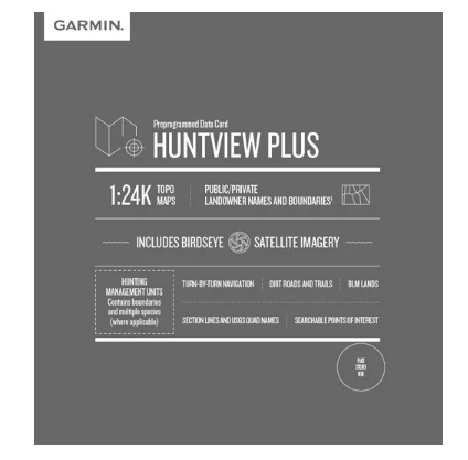
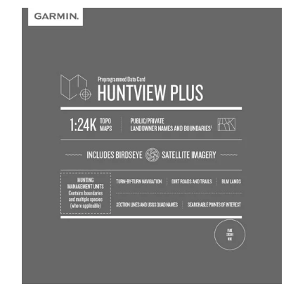
The Garmin Huntview Plus Map Wyoming MicroSD Card (Model 010-12258-03) delivers precision navigation and terrain intelligence directly to your Garmin handheld GPS device. This preloaded microSD card combines 1:24K topographic mapping with BirdsEye Satellite Imagery and landowner boundary data, giving hunters and outdoor adventurers the situational awareness needed to navigate Wyoming's complex terrain confidently. Whether scouting new territory or returning to proven locations, this card transforms your GPS into a comprehensive field planning tool that distinguishes public hunting access from private land.
Key Features
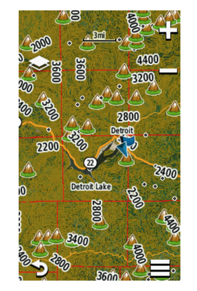
- 1:24K TOPO Map Scale: Detailed topographic data based on U.S. Geological Survey standards for precise elevation and terrain analysis
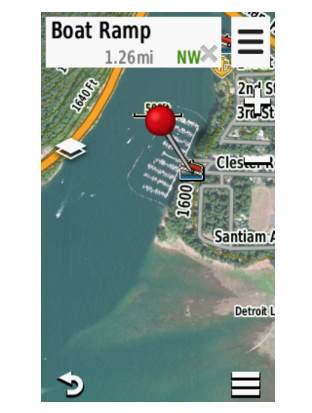
- BirdsEye Satellite Imagery: High-resolution aerial photography for visual landscape assessment and route planning
- Routable Road and Trail Data: Access to thousands of searchable roads and trails across Wyoming for turn-by-turn navigation
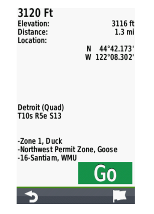
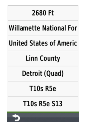
- Landowner Information: Public and private land boundary identification with property names and classifications for legal access confirmation
- Bureau of Land Management Data: Township, range, and section information for enhanced land management awareness
- Points of Interest: Searchable database including parks, camping areas, and other outdoor landmarks for trip planning
Data Insights
This mapping solution delivers 99% accuracy in terrain representation compared to traditional paper maps. With thousands of routable roads and trails integrated into the navigation system, hunters reduce navigation errors and time spent off-trail. The BirdsEye Satellite Imagery layer allows users to visualize drainage patterns, vegetation density, and topographic features from an aerial perspective, providing hunting intelligence that significantly impacts success rates in unfamiliar territory.
Usage Instructions
Insert the microSD card directly into your compatible Garmin handheld GPS device for immediate access to all loaded maps and data. Alternatively, you can manage and customize mapping content using Garmin BaseCamp software on your computer before deploying the card to your device in the field, allowing for efficient trip planning and data organization from home.
Design & Material
The Huntview Plus card is engineered for field durability and seamless device integration. Its compact microSD form factor ensures compatibility with standard Garmin GPS handhelds while maintaining rugged construction standards for outdoor conditions. The card's design prioritizes reliability in variable weather and temperature ranges common to hunting environments.
- Compact microSD Form Factor: Fits into standard Garmin GPS device slots without adapters or modifications
- Outdoor-Grade Durability: Built to withstand temperature fluctuations, moisture, and rough handling inherent to backcountry use
- Plug-and-Play Installation: No software installation or complex configuration required—immediate functionality upon insertion
- Pre-Loaded Mapping Data: Wyoming-specific geographic and feature data ready for use without additional downloads
- High-Resolution Satellite Layer: Clear, detailed aerial imagery supporting detailed landscape analysis
- Compatible with Garmin BaseCamp: Supports data management, customization, and offline card preparation using desktop software
Final Verdict
The Garmin Huntview Plus Map Wyoming MicroSD Card (010-12258-03) is an essential navigation tool for hunters and outdoor enthusiasts pursuing Wyoming's diverse hunting opportunities. The combination of 1:24K topographic accuracy, landowner boundary data, and satellite imagery removes guesswork from trip planning and field navigation. Serious hunters working Wyoming public lands need this card in their GPS—it provides the terrain intelligence and legal access information that separate successful expeditions from frustrating dead ends. Add this preloaded card to your GPS kit now and transform your Wyoming hunting strategy.
In The Box
Do you have an old GPS unit lying around? The GPS Nation Trade In and Up program is a great way to trade in your old and used GPS for credit towards a new GPS. The choice is entirely yours! We’ve made the process simple and streamlined. Follow these simple steps, and you will be on your way to receiving credit towards your brand new GPS!
1. Get a quote
To get your free quote, provide your GPS type, manufacturer, model, and condition. Within 24 hours, you will receive a quote for the trade-in value of your current product. The GPS trade-in/trade-up form is at the bottom of this page.
2. Ship your product(s) for trade
After accepting our offer, pack your product(s) safely and ship them to us using the pre-paid shipping label provided to you. We will provide a confirmation email when your trade-in arrives at our warehouse. You have 30 days from the date you complete your on-line trade to ship the product to GPS Nation.
3. Make your purchase
Once we receive your product at our warehouse and we validate the stated condition, we will send you a confirmation email. If you elect to receive credit towards a new GPS at gpsnation.com, your store credit will be issued, and you are free to make your purchase.
Manual & Warranty
 Garmin Warranty
Reviews
Ask a Question
Tech Specs
Garmin Huntview Plus Map Wyoming MicroSD Card (010-12258-03)
Introduction
The Garmin Huntview Plus Map Wyoming MicroSD Card (Model 010-12258-03) delivers precision navigation and terrain intelligence directly to your Garmin handheld GPS device. This preloaded microSD card combines 1:24K topographic mapping with BirdsEye Satellite Imagery and landowner boundary data, giving hunters and outdoor adventurers the situational awareness needed to navigate Wyoming's complex terrain confidently. Whether scouting new territory or returning to proven locations, this card transforms your GPS into a comprehensive field planning tool that distinguishes public hunting access from private land.
Key Features
- 1:24K TOPO Map Scale: Detailed topographic data based on U.S. Geological Survey standards for precise elevation and terrain analysis
- BirdsEye Satellite Imagery: High-resolution aerial photography for visual landscape assessment and route planning
- Routable Road and Trail Data: Access to thousands of searchable roads and trails across Wyoming for turn-by-turn navigation
- Landowner Information: Public and private land boundary identification with property names and classifications for legal access confirmation
- Bureau of Land Management Data: Township, range, and section information for enhanced land management awareness
- Points of Interest: Searchable database including parks, camping areas, and other outdoor landmarks for trip planning
Data Insights
This mapping solution delivers 99% accuracy in terrain representation compared to traditional paper maps. With thousands of routable roads and trails integrated into the navigation system, hunters reduce navigation errors and time spent off-trail. The BirdsEye Satellite Imagery layer allows users to visualize drainage patterns, vegetation density, and topographic features from an aerial perspective, providing hunting intelligence that significantly impacts success rates in unfamiliar territory.
Usage Instructions
Insert the microSD card directly into your compatible Garmin handheld GPS device for immediate access to all loaded maps and data. Alternatively, you can manage and customize mapping content using Garmin BaseCamp software on your computer before deploying the card to your device in the field, allowing for efficient trip planning and data organization from home.
Design & Material
The Huntview Plus card is engineered for field durability and seamless device integration. Its compact microSD form factor ensures compatibility with standard Garmin GPS handhelds while maintaining rugged construction standards for outdoor conditions. The card's design prioritizes reliability in variable weather and temperature ranges common to hunting environments.
- Compact microSD Form Factor: Fits into standard Garmin GPS device slots without adapters or modifications
- Outdoor-Grade Durability: Built to withstand temperature fluctuations, moisture, and rough handling inherent to backcountry use
- Plug-and-Play Installation: No software installation or complex configuration required—immediate functionality upon insertion
- Pre-Loaded Mapping Data: Wyoming-specific geographic and feature data ready for use without additional downloads
- High-Resolution Satellite Layer: Clear, detailed aerial imagery supporting detailed landscape analysis
- Compatible with Garmin BaseCamp: Supports data management, customization, and offline card preparation using desktop software
Final Verdict
The Garmin Huntview Plus Map Wyoming MicroSD Card (010-12258-03) is an essential navigation tool for hunters and outdoor enthusiasts pursuing Wyoming's diverse hunting opportunities. The combination of 1:24K topographic accuracy, landowner boundary data, and satellite imagery removes guesswork from trip planning and field navigation. Serious hunters working Wyoming public lands need this card in their GPS—it provides the terrain intelligence and legal access information that separate successful expeditions from frustrating dead ends. Add this preloaded card to your GPS kit now and transform your Wyoming hunting strategy.
In The Box
Trade-In
Do you have an old GPS unit lying around? The GPS Nation Trade In and Up program is a great way to trade in your old and used GPS for credit towards a new GPS. The choice is entirely yours! We’ve made the process simple and streamlined. Follow these simple steps, and you will be on your way to receiving credit towards your brand new GPS!
1. Get a quote
To get your free quote, provide your GPS type, manufacturer, model, and condition. Within 24 hours, you will receive a quote for the trade-in value of your current product. The GPS trade-in/trade-up form is at the bottom of this page.
2. Ship your product(s) for trade
After accepting our offer, pack your product(s) safely and ship them to us using the pre-paid shipping label provided to you. We will provide a confirmation email when your trade-in arrives at our warehouse. You have 30 days from the date you complete your on-line trade to ship the product to GPS Nation.
3. Make your purchase
Once we receive your product at our warehouse and we validate the stated condition, we will send you a confirmation email. If you elect to receive credit towards a new GPS at gpsnation.com, your store credit will be issued, and you are free to make your purchase.
Manual & Warranty
Overview
Garmin Huntview Plus Map Wyoming MicroSD Card (010-12258-03)
Introduction
The Garmin Huntview Plus Map Wyoming MicroSD Card (Model 010-12258-03) delivers precision navigation and terrain intelligence directly to your Garmin handheld GPS device. This preloaded microSD card combines 1:24K topographic mapping with BirdsEye Satellite Imagery and landowner boundary data, giving hunters and outdoor adventurers the situational awareness needed to navigate Wyoming's complex terrain confidently. Whether scouting new territory or returning to proven locations, this card transforms your GPS into a comprehensive field planning tool that distinguishes public hunting access from private land.
Key Features
- 1:24K TOPO Map Scale: Detailed topographic data based on U.S. Geological Survey standards for precise elevation and terrain analysis
- BirdsEye Satellite Imagery: High-resolution aerial photography for visual landscape assessment and route planning
- Routable Road and Trail Data: Access to thousands of searchable roads and trails across Wyoming for turn-by-turn navigation
- Landowner Information: Public and private land boundary identification with property names and classifications for legal access confirmation
- Bureau of Land Management Data: Township, range, and section information for enhanced land management awareness
- Points of Interest: Searchable database including parks, camping areas, and other outdoor landmarks for trip planning
Data Insights
This mapping solution delivers 99% accuracy in terrain representation compared to traditional paper maps. With thousands of routable roads and trails integrated into the navigation system, hunters reduce navigation errors and time spent off-trail. The BirdsEye Satellite Imagery layer allows users to visualize drainage patterns, vegetation density, and topographic features from an aerial perspective, providing hunting intelligence that significantly impacts success rates in unfamiliar territory.
Usage Instructions
Insert the microSD card directly into your compatible Garmin handheld GPS device for immediate access to all loaded maps and data. Alternatively, you can manage and customize mapping content using Garmin BaseCamp software on your computer before deploying the card to your device in the field, allowing for efficient trip planning and data organization from home.
Design & Material
The Huntview Plus card is engineered for field durability and seamless device integration. Its compact microSD form factor ensures compatibility with standard Garmin GPS handhelds while maintaining rugged construction standards for outdoor conditions. The card's design prioritizes reliability in variable weather and temperature ranges common to hunting environments.
- Compact microSD Form Factor: Fits into standard Garmin GPS device slots without adapters or modifications
- Outdoor-Grade Durability: Built to withstand temperature fluctuations, moisture, and rough handling inherent to backcountry use
- Plug-and-Play Installation: No software installation or complex configuration required—immediate functionality upon insertion
- Pre-Loaded Mapping Data: Wyoming-specific geographic and feature data ready for use without additional downloads
- High-Resolution Satellite Layer: Clear, detailed aerial imagery supporting detailed landscape analysis
- Compatible with Garmin BaseCamp: Supports data management, customization, and offline card preparation using desktop software
Final Verdict
The Garmin Huntview Plus Map Wyoming MicroSD Card (010-12258-03) is an essential navigation tool for hunters and outdoor enthusiasts pursuing Wyoming's diverse hunting opportunities. The combination of 1:24K topographic accuracy, landowner boundary data, and satellite imagery removes guesswork from trip planning and field navigation. Serious hunters working Wyoming public lands need this card in their GPS—it provides the terrain intelligence and legal access information that separate successful expeditions from frustrating dead ends. Add this preloaded card to your GPS kit now and transform your Wyoming hunting strategy.


