


Garmin Huntview Plus Maps DE + MD + NJ + DC microSD Card (010-12681-51)
Garmin Huntview Plus Maps DE + MD + NJ + DC microSD Card (010-12681-51)
Model Number: 010-12681-51
Low stock
 WhatsApp
 SMS - Text us!
 Email Us!
 Help Desk

Tech Specs
Garmin Huntview Plus Maps DE + MD + NJ + DC microSD Card (010-12681-51)
Introduction
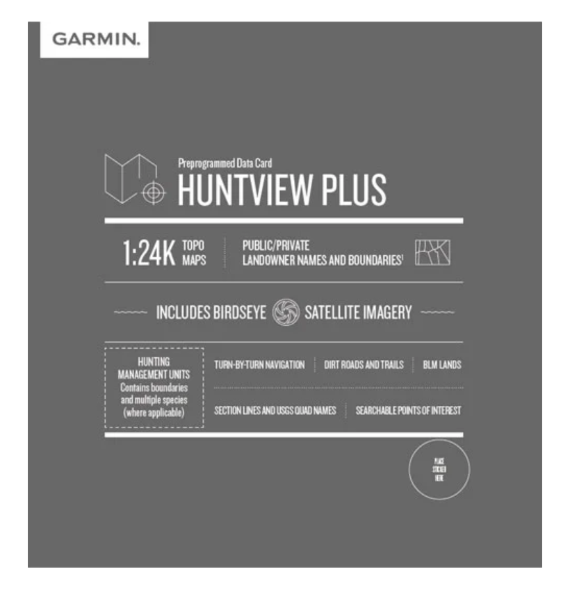
The Garmin Huntview Plus Maps microSD card (model 010-12681-51) delivers detailed topographical mapping and landowner data across Delaware, Maryland, New Jersey, and Washington D.C.—essential intelligence for hunters and outdoor professionals navigating multi-state regions. Unlike standard GPS maps, this card integrates hunting management unit boundaries, private and public land designations, and over 10,000 miles of routable roads and trails, allowing you to plan routes and identify accessible hunting areas before you leave your vehicle.
Key Features
- 1:24,000 Scale Topographical Maps: Equivalent detail to U.S. Geological Survey quad sheets for precise terrain understanding
- Complete Road and Trail Network: Routable mapping of thousands of roads and trails across all four state regions
- Landowner Names and Boundaries: Searchable public and private land designations, including BLM, National Wildlife Refuges, and National Parks
- Hunting Management Unit Data: Displays boundaries and multiple species information for each unit across covered states
- BLM Township and Section Lines: Bureau of Land Management grid information for precise land navigation and identification
- Searchable Points of Interest: Locate parks, summits, camping areas, and other outdoor amenities with a single search query
- Turn-by-Turn Navigation: Compatible with Garmin GPS devices for real-time route guidance
Data Insights
Hunters and outdoor professionals gain significant navigation efficiency with this microSD card's comprehensive dataset. The mapping includes over 10,000 miles of roads and trails across the four-state region, reducing the time spent planning routes and increasing the likelihood of accessing prime hunting areas during limited seasons. The inclusion of specific landowner information directly addresses trespassing concerns—a critical legal issue in states like New Jersey and Maryland where private property boundaries are densely distributed—while BLM and wildlife refuge boundaries ensure compliance with access regulations.
Usage Instructions
Insert the microSD card into a compatible Garmin GPS device, or download the maps onto a blank microSD card using your computer for immediate activation. Verify that your Garmin device software is current to ensure all mapping features, including hunting management unit layers and landowner data, display correctly. Once loaded, maps are accessible offline, so no cellular connection is required while in the field.
Design and Material
This microSD card combines durability with compact portability. The card's small form factor fits seamlessly into Garmin handheld units, automotive navigators, and mapping software without requiring external adapters or modifications. Construction prioritizes reliability in outdoor conditions—from temperature fluctuations during early morning hunting to exposure to moisture and dust.
- Compact microSD Form Factor: Fits all Garmin GPS devices without additional hardware or bulky adapters
- Weather-Resistant Construction: Engineered to function reliably in rain, snow, and temperature extremes typical of hunting seasons
- Durable Storage Media: High-quality flash memory built to withstand repeated use and environmental stress
- Clear, Detailed Graphics: Topographical contours and boundary lines render with precision for accurate field navigation
- Easy Installation: No software drivers or complex setup—insert and navigate immediately
- Offline Functionality: Maps stored locally on the card eliminate dependency on cellular networks or satellite connectivity in remote areas
Final Verdict
The Garmin Huntview Plus Maps DE + MD + NJ + DC microSD Card (010-12681-51) is essential equipment for serious hunters and land managers working across the Mid-Atlantic region. Its combination of precise topographical detail, landowner boundaries, hunting management unit data, and thousands of routable trails directly solves the core problem of hunting access planning and legal compliance. Whether navigating unfamiliar WMA boundaries or confirming private land ownership before entry, this card delivers the specific regional intelligence generic mapping tools cannot provide. Purchase today to eliminate navigation uncertainty and maximize your hunting season success.
In The Box
Do you have an old GPS unit lying around? The GPS Nation Trade In and Up program is a great way to trade in your old and used GPS for credit towards a new GPS. The choice is entirely yours! We’ve made the process simple and streamlined. Follow these simple steps, and you will be on your way to receiving credit towards your brand new GPS!
1. Get a quote
To get your free quote, provide your GPS type, manufacturer, model, and condition. Within 24 hours, you will receive a quote for the trade-in value of your current product. The GPS trade-in/trade-up form is at the bottom of this page.
2. Ship your product(s) for trade
After accepting our offer, pack your product(s) safely and ship them to us using the pre-paid shipping label provided to you. We will provide a confirmation email when your trade-in arrives at our warehouse. You have 30 days from the date you complete your on-line trade to ship the product to GPS Nation.
3. Make your purchase
Once we receive your product at our warehouse and we validate the stated condition, we will send you a confirmation email. If you elect to receive credit towards a new GPS at gpsnation.com, your store credit will be issued, and you are free to make your purchase.
Manual & Warranty
 Garmin Warranty
Reviews
Ask a Question
Tech Specs
Garmin Huntview Plus Maps DE + MD + NJ + DC microSD Card (010-12681-51)
Introduction
The Garmin Huntview Plus Maps microSD card (model 010-12681-51) delivers detailed topographical mapping and landowner data across Delaware, Maryland, New Jersey, and Washington D.C.—essential intelligence for hunters and outdoor professionals navigating multi-state regions. Unlike standard GPS maps, this card integrates hunting management unit boundaries, private and public land designations, and over 10,000 miles of routable roads and trails, allowing you to plan routes and identify accessible hunting areas before you leave your vehicle.
Key Features
- 1:24,000 Scale Topographical Maps: Equivalent detail to U.S. Geological Survey quad sheets for precise terrain understanding
- Complete Road and Trail Network: Routable mapping of thousands of roads and trails across all four state regions
- Landowner Names and Boundaries: Searchable public and private land designations, including BLM, National Wildlife Refuges, and National Parks
- Hunting Management Unit Data: Displays boundaries and multiple species information for each unit across covered states
- BLM Township and Section Lines: Bureau of Land Management grid information for precise land navigation and identification
- Searchable Points of Interest: Locate parks, summits, camping areas, and other outdoor amenities with a single search query
- Turn-by-Turn Navigation: Compatible with Garmin GPS devices for real-time route guidance
Data Insights
Hunters and outdoor professionals gain significant navigation efficiency with this microSD card's comprehensive dataset. The mapping includes over 10,000 miles of roads and trails across the four-state region, reducing the time spent planning routes and increasing the likelihood of accessing prime hunting areas during limited seasons. The inclusion of specific landowner information directly addresses trespassing concerns—a critical legal issue in states like New Jersey and Maryland where private property boundaries are densely distributed—while BLM and wildlife refuge boundaries ensure compliance with access regulations.
Usage Instructions
Insert the microSD card into a compatible Garmin GPS device, or download the maps onto a blank microSD card using your computer for immediate activation. Verify that your Garmin device software is current to ensure all mapping features, including hunting management unit layers and landowner data, display correctly. Once loaded, maps are accessible offline, so no cellular connection is required while in the field.
Design and Material
This microSD card combines durability with compact portability. The card's small form factor fits seamlessly into Garmin handheld units, automotive navigators, and mapping software without requiring external adapters or modifications. Construction prioritizes reliability in outdoor conditions—from temperature fluctuations during early morning hunting to exposure to moisture and dust.
- Compact microSD Form Factor: Fits all Garmin GPS devices without additional hardware or bulky adapters
- Weather-Resistant Construction: Engineered to function reliably in rain, snow, and temperature extremes typical of hunting seasons
- Durable Storage Media: High-quality flash memory built to withstand repeated use and environmental stress
- Clear, Detailed Graphics: Topographical contours and boundary lines render with precision for accurate field navigation
- Easy Installation: No software drivers or complex setup—insert and navigate immediately
- Offline Functionality: Maps stored locally on the card eliminate dependency on cellular networks or satellite connectivity in remote areas
Final Verdict
The Garmin Huntview Plus Maps DE + MD + NJ + DC microSD Card (010-12681-51) is essential equipment for serious hunters and land managers working across the Mid-Atlantic region. Its combination of precise topographical detail, landowner boundaries, hunting management unit data, and thousands of routable trails directly solves the core problem of hunting access planning and legal compliance. Whether navigating unfamiliar WMA boundaries or confirming private land ownership before entry, this card delivers the specific regional intelligence generic mapping tools cannot provide. Purchase today to eliminate navigation uncertainty and maximize your hunting season success.
In The Box
Trade-In
Do you have an old GPS unit lying around? The GPS Nation Trade In and Up program is a great way to trade in your old and used GPS for credit towards a new GPS. The choice is entirely yours! We’ve made the process simple and streamlined. Follow these simple steps, and you will be on your way to receiving credit towards your brand new GPS!
1. Get a quote
To get your free quote, provide your GPS type, manufacturer, model, and condition. Within 24 hours, you will receive a quote for the trade-in value of your current product. The GPS trade-in/trade-up form is at the bottom of this page.
2. Ship your product(s) for trade
After accepting our offer, pack your product(s) safely and ship them to us using the pre-paid shipping label provided to you. We will provide a confirmation email when your trade-in arrives at our warehouse. You have 30 days from the date you complete your on-line trade to ship the product to GPS Nation.
3. Make your purchase
Once we receive your product at our warehouse and we validate the stated condition, we will send you a confirmation email. If you elect to receive credit towards a new GPS at gpsnation.com, your store credit will be issued, and you are free to make your purchase.
Manual & Warranty
Overview
Garmin Huntview Plus Maps DE + MD + NJ + DC microSD Card (010-12681-51)
Introduction
The Garmin Huntview Plus Maps microSD card (model 010-12681-51) delivers detailed topographical mapping and landowner data across Delaware, Maryland, New Jersey, and Washington D.C.—essential intelligence for hunters and outdoor professionals navigating multi-state regions. Unlike standard GPS maps, this card integrates hunting management unit boundaries, private and public land designations, and over 10,000 miles of routable roads and trails, allowing you to plan routes and identify accessible hunting areas before you leave your vehicle.
Key Features
- 1:24,000 Scale Topographical Maps: Equivalent detail to U.S. Geological Survey quad sheets for precise terrain understanding
- Complete Road and Trail Network: Routable mapping of thousands of roads and trails across all four state regions
- Landowner Names and Boundaries: Searchable public and private land designations, including BLM, National Wildlife Refuges, and National Parks
- Hunting Management Unit Data: Displays boundaries and multiple species information for each unit across covered states
- BLM Township and Section Lines: Bureau of Land Management grid information for precise land navigation and identification
- Searchable Points of Interest: Locate parks, summits, camping areas, and other outdoor amenities with a single search query
- Turn-by-Turn Navigation: Compatible with Garmin GPS devices for real-time route guidance
Data Insights
Hunters and outdoor professionals gain significant navigation efficiency with this microSD card's comprehensive dataset. The mapping includes over 10,000 miles of roads and trails across the four-state region, reducing the time spent planning routes and increasing the likelihood of accessing prime hunting areas during limited seasons. The inclusion of specific landowner information directly addresses trespassing concerns—a critical legal issue in states like New Jersey and Maryland where private property boundaries are densely distributed—while BLM and wildlife refuge boundaries ensure compliance with access regulations.
Usage Instructions
Insert the microSD card into a compatible Garmin GPS device, or download the maps onto a blank microSD card using your computer for immediate activation. Verify that your Garmin device software is current to ensure all mapping features, including hunting management unit layers and landowner data, display correctly. Once loaded, maps are accessible offline, so no cellular connection is required while in the field.
Design and Material
This microSD card combines durability with compact portability. The card's small form factor fits seamlessly into Garmin handheld units, automotive navigators, and mapping software without requiring external adapters or modifications. Construction prioritizes reliability in outdoor conditions—from temperature fluctuations during early morning hunting to exposure to moisture and dust.
- Compact microSD Form Factor: Fits all Garmin GPS devices without additional hardware or bulky adapters
- Weather-Resistant Construction: Engineered to function reliably in rain, snow, and temperature extremes typical of hunting seasons
- Durable Storage Media: High-quality flash memory built to withstand repeated use and environmental stress
- Clear, Detailed Graphics: Topographical contours and boundary lines render with precision for accurate field navigation
- Easy Installation: No software drivers or complex setup—insert and navigate immediately
- Offline Functionality: Maps stored locally on the card eliminate dependency on cellular networks or satellite connectivity in remote areas
Final Verdict
The Garmin Huntview Plus Maps DE + MD + NJ + DC microSD Card (010-12681-51) is essential equipment for serious hunters and land managers working across the Mid-Atlantic region. Its combination of precise topographical detail, landowner boundaries, hunting management unit data, and thousands of routable trails directly solves the core problem of hunting access planning and legal compliance. Whether navigating unfamiliar WMA boundaries or confirming private land ownership before entry, this card delivers the specific regional intelligence generic mapping tools cannot provide. Purchase today to eliminate navigation uncertainty and maximize your hunting season success.


