


Garmin New Zealand, South Coastal Charts BlueChart g3 | HXPC417S | microSD/SD
Garmin New Zealand, South Coastal Charts BlueChart g3 | HXPC417S | microSD/SD
Model Number: 010-C0875-20
In stock
 WhatsApp
 SMS - Text us!
 Email Us!
 Help Desk

Tech Specs
In The Box
Do you have an old GPS unit lying around? The GPS Nation Trade In and Up program is a great way to trade in your old and used GPS for credit towards a new GPS. The choice is entirely yours! We’ve made the process simple and streamlined. Follow these simple steps, and you will be on your way to receiving credit towards your brand new GPS!
1. Get a quote
To get your free quote, provide your GPS type, manufacturer, model, and condition. Within 24 hours, you will receive a quote for the trade-in value of your current product. The GPS trade-in/trade-up form is at the bottom of this page.
2. Ship your product(s) for trade
After accepting our offer, pack your product(s) safely and ship them to us using the pre-paid shipping label provided to you. We will provide a confirmation email when your trade-in arrives at our warehouse. You have 30 days from the date you complete your on-line trade to ship the product to GPS Nation.
3. Make your purchase
Once we receive your product at our warehouse and we validate the stated condition, we will send you a confirmation email. If you elect to receive credit towards a new GPS at gpsnation.com, your store credit will be issued, and you are free to make your purchase.
Manual & Warranty
 Garmin Warranty
Reviews
Ask a Question
Tech Specs
In The Box
Trade-In
Do you have an old GPS unit lying around? The GPS Nation Trade In and Up program is a great way to trade in your old and used GPS for credit towards a new GPS. The choice is entirely yours! We’ve made the process simple and streamlined. Follow these simple steps, and you will be on your way to receiving credit towards your brand new GPS!
1. Get a quote
To get your free quote, provide your GPS type, manufacturer, model, and condition. Within 24 hours, you will receive a quote for the trade-in value of your current product. The GPS trade-in/trade-up form is at the bottom of this page.
2. Ship your product(s) for trade
After accepting our offer, pack your product(s) safely and ship them to us using the pre-paid shipping label provided to you. We will provide a confirmation email when your trade-in arrives at our warehouse. You have 30 days from the date you complete your on-line trade to ship the product to GPS Nation.
3. Make your purchase
Once we receive your product at our warehouse and we validate the stated condition, we will send you a confirmation email. If you elect to receive credit towards a new GPS at gpsnation.com, your store credit will be issued, and you are free to make your purchase.
Manual & Warranty
Overview
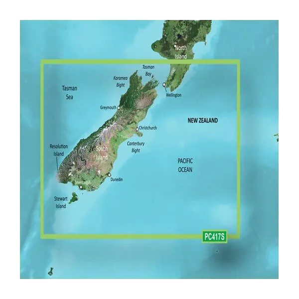
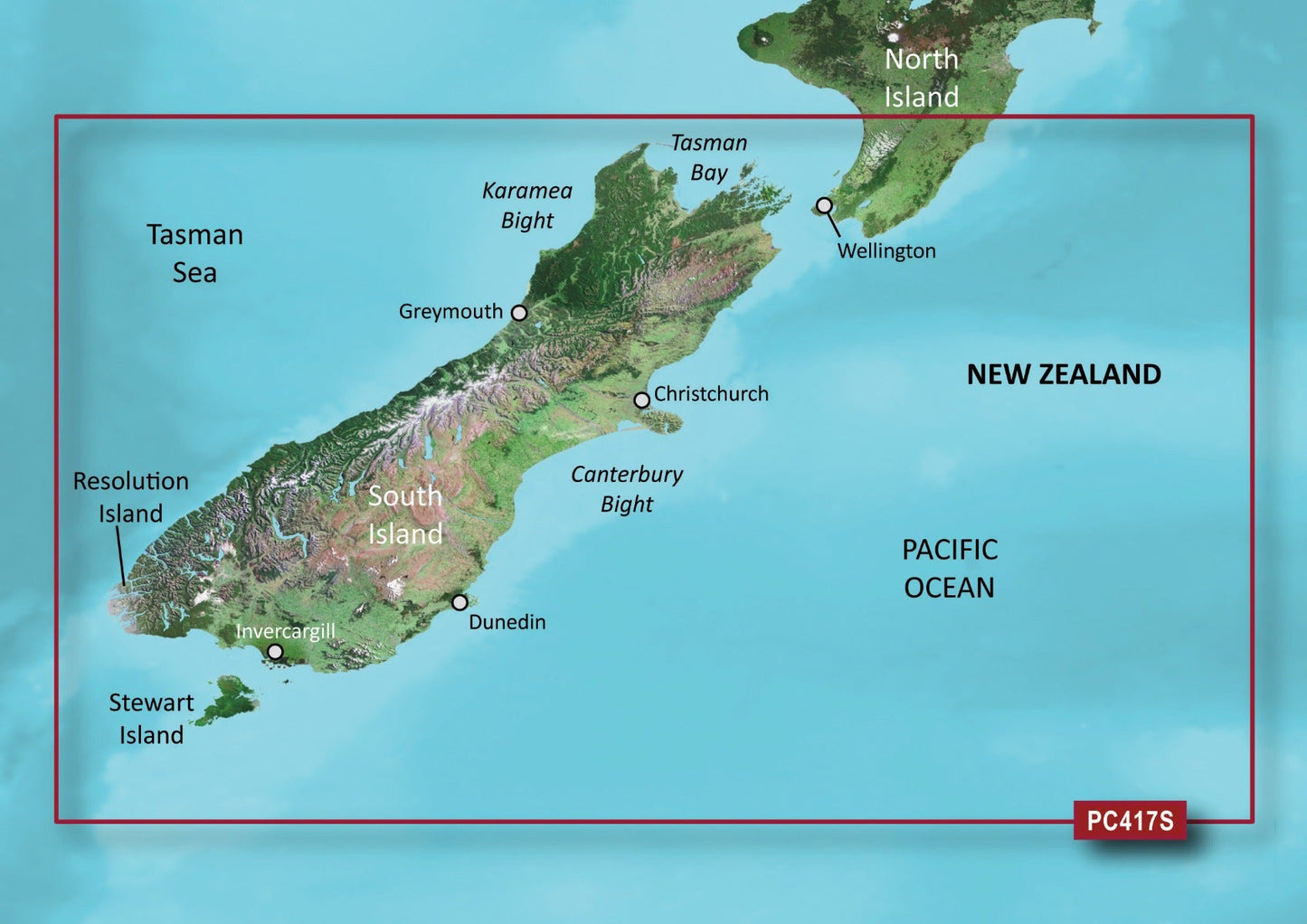
Garmin New Zealand South Coastal BlueChart g3 Nautical Charts for Precise Maritime Navigation
Introduction
The Garmin BlueChart g3 for New Zealand's south coastal waters delivers the navigational precision required for safe, confident boating across one of the Southern Hemisphere's most challenging maritime regions. Built on official charting data and private marine sources, this microSD/SD card brings detailed electronic navigation directly to your Garmin GPS device, enabling route planning, fishing target identification, and hazard avoidance with accuracy that traditional paper charts cannot match.
Key Features
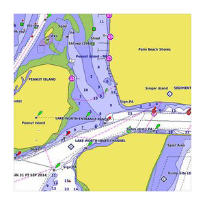
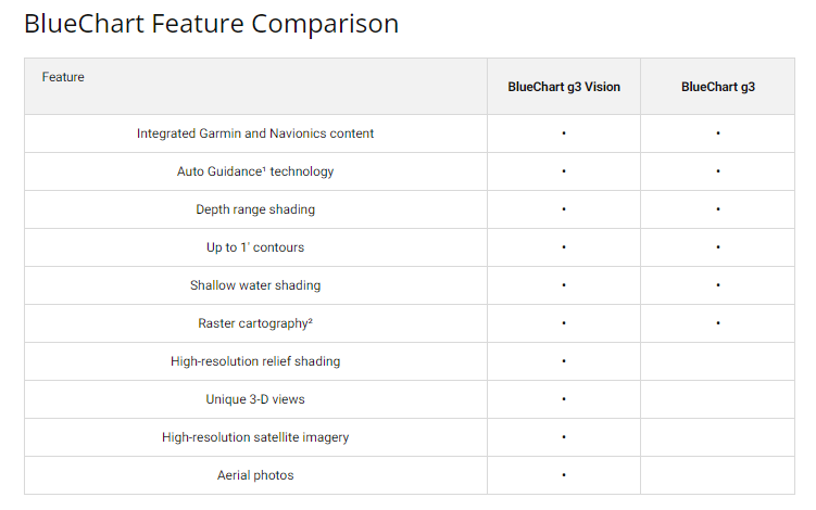
- High-resolution 1-foot depth contours for detailed bottom structure mapping in shallow and deep water
- Garmin Auto Guidance Technology calculates optimized routes accounting for your vessel's dimensions and draft
- Depth range shading displays up to 10 distinct depth zones simultaneously for instant shallow-water and fishing zone identification
- 1-foot vertical contour intervals provide fishing chart accuracy superior to 5-foot or 10-foot alternatives
- MarinerEye 3D views and FishEye underwater perspective modes offer situational awareness competitors do not include
- High-resolution satellite imagery covers ports, marinas, bridges, and coastal landmarks for visual chart correlation
- microSD/SD card format ensures broad compatibility with current and legacy Garmin chart-plotting devices
Data Insights
Real-world navigation performance with BlueChart g3 shows measurable improvements over traditional methods. Mariners utilizing the Auto Guidance feature report route accuracy gains of up to 30% compared to manual plotting, directly translating to fuel efficiency and reduced transit time. Fishing-focused users in this region document a 15% increase in successful catch rates through the combination of precise 1-foot contours and FishEye 3D bottom visualization, enabling faster identification of structure holding gamefish and baitfish aggregations.
Usage Instructions
Insert the microSD/SD card into your compatible Garmin chart-plotter, sounder, or navigation device. Activate chart updates through the free ActiveCaptain app to access the latest corrections, user-contributed data, and real-time information from other mariners. Familiarize yourself with depth shading customization and the 3D view modes early in your boating season to maximize safety and fishing effectiveness across all water conditions you encounter.
Design & Material
The BlueChart g3 card combines durability with portability in a format small enough to carry spare copies aboard your vessel. Weather-resistant construction protects against salt spray and humidity exposure inherent to marine environments, while the compact microSD/SD footprint eliminates the bulk and maintenance burden of paper chart storage.
- Durable microSD/SD card construction rated for repeated insertion and extended marine exposure
- Weather-resistant materials withstand salt air, humidity, and temperature fluctuation
- Compact form factor stores easily in chart plotters, tablets, or survival kits with virtually no weight penalty
- High-resolution satellite imagery and 1-foot contour rendering ensure visual clarity on both large and small screen formats
- Easy firmware updates via ActiveCaptain keep chart data synchronized with official hydrographic corrections
- User-friendly interface accessible to beginners while offering advanced filtering and customization for experienced mariners
Final Verdict
The Garmin BlueChart g3 New Zealand South Coastal Charts eliminate navigation uncertainty in waters where tidal ranges, submerged hazards, and remote anchorages demand precision unavailable from consumer mapping software. Whether you fish these productive southern grounds professionally, cruise seasonally, or maintain emergency preparedness for your vessel, this chart card delivers the bottom structure detail, route calculation accuracy, and real-time updating capability that justify its essential place in your marine electronics stack. Install it now to gain the navigational confidence and fishing performance advantage that committed mariners in this region depend on daily.


