


Garmin TOPO Iceland v6 Light
Garmin TOPO Iceland v6 Light
Model Number: 010-D1693-04
Out of stock
 WhatsApp
 SMS - Text us!
 Email Us!
 Help Desk

Tech Specs
Garmin TOPO Iceland v6 Light — Detailed Topographic Mapping for Iceland Outdoor Navigation
Introduction
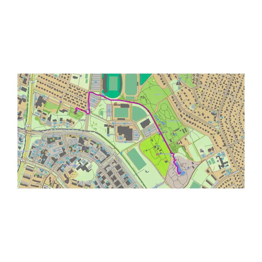
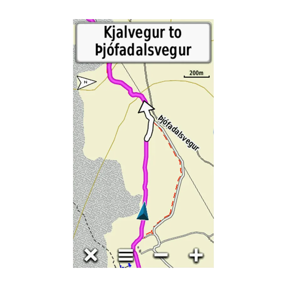
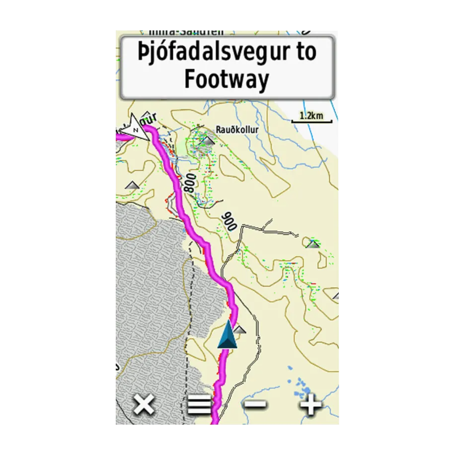
The Garmin TOPO Iceland v6 Light delivers precise, community-verified topographic mapping data specifically tailored for Iceland's unique terrain, enabling hikers, backcountry explorers, and outdoor adventurers to navigate glaciers, mountain passes, and remote valleys with confidence. This map software integrates detailed elevation contours, slope overlays, and comprehensive trail networks directly into compatible Garmin handheld GPS devices, transforming route planning from speculative to data-driven and significantly reducing navigation errors in Iceland's challenging landscape.
Key Features
- OpenStreetMap-Based Database: Built on community-generated mapping data verified by thousands of contributors for accuracy and real-world reliability
- Extensive Trail Coverage: Includes tens of thousands of kilometers of documented roads, hiking trails, and recreational paths across Iceland's interior and coastal regions
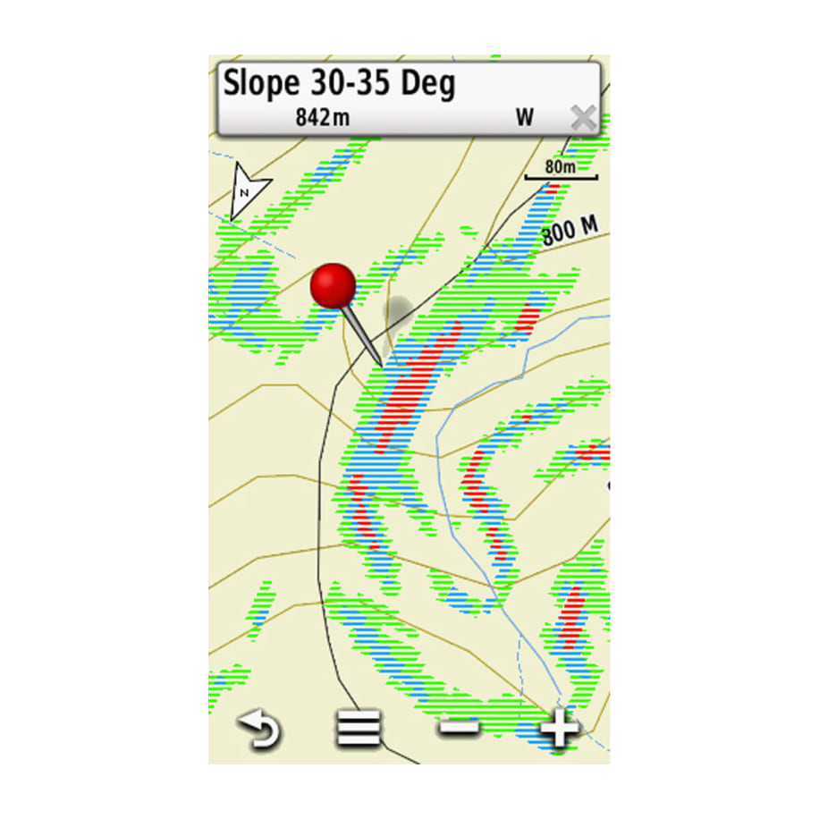
- Slope Mapping Overlay: Visual slope gradient data allows route planning that avoids terrain steeper than 30–45 degrees, critical for avalanche-prone areas and scree fields
- Topographic Detail with 30% Regional Coverage: Detailed contour lines and elevation data cover more than 30% of Iceland, including major hiking zones and high-altitude plateaus
- Hydrographic and Terrain Features: Displays glaciers, major mountain summits, river systems, water crossings, and seasonal stream data for comprehensive terrain awareness
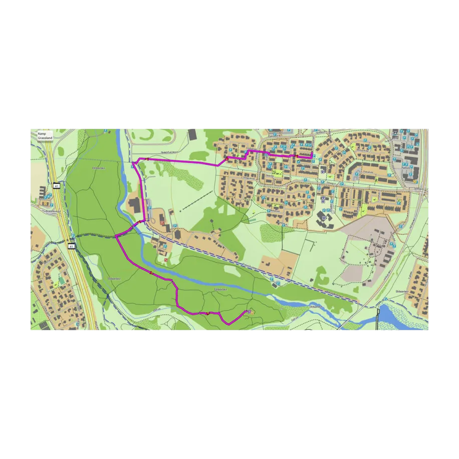
- Searchable Points of Interest: Includes petrol stations, mountain huts, water refill points, accommodations, restaurants, and emergency services across populated areas
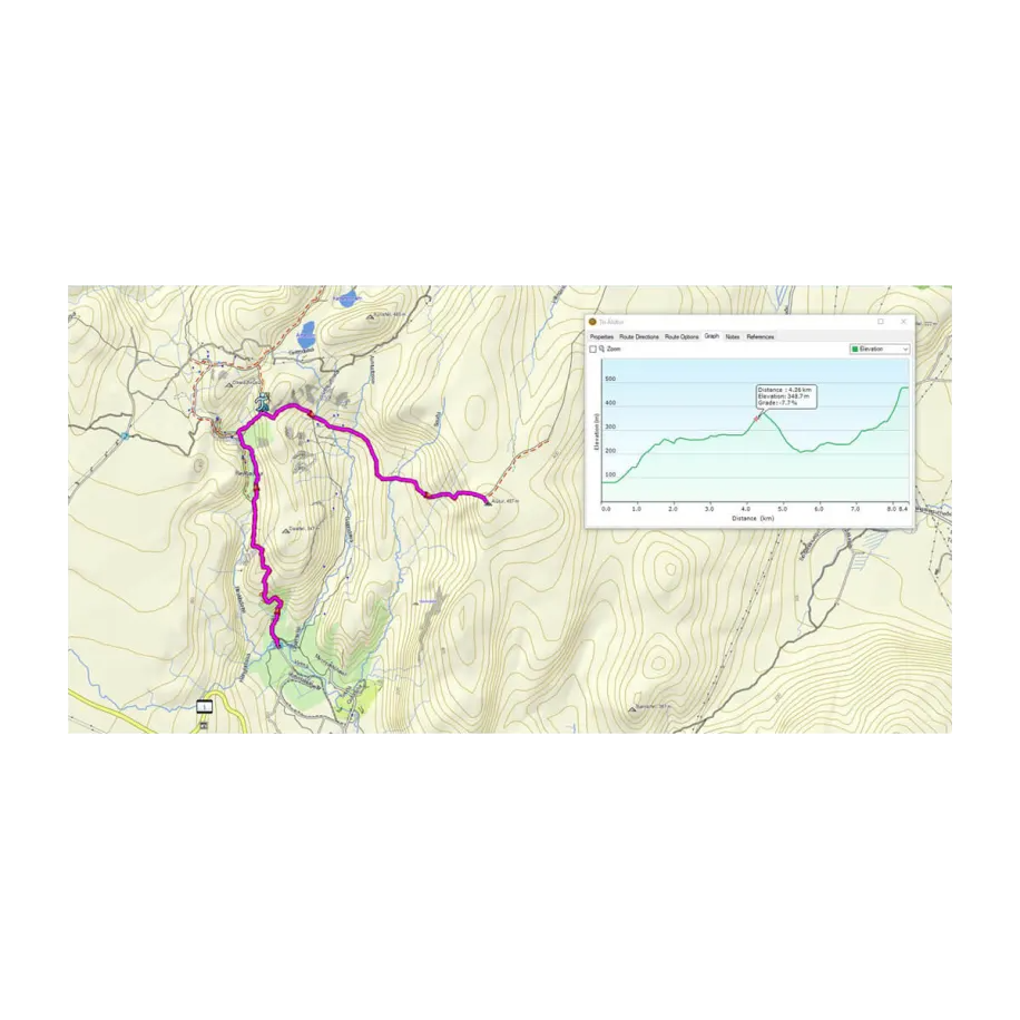
- BaseCamp Software Integration: Route preview and elevation profile analysis before you depart, allowing pre-trip hazard assessment and pace estimation
Data Insights
Navigating Iceland's remote terrain demands precision that standard maps cannot provide. The Garmin TOPO Iceland v6 Light combines slope data with elevation contours, reducing route-finding uncertainty in areas where weather deteriorates visibility within minutes. Users planning high-altitude crossings benefit from identifying gradients exceeding safe hiking thresholds, while trail data accuracy—validated through OpenStreetMap's collaborative model—ensures you're following established routes rather than GPS drift in Iceland's magnetic anomalies. The inclusion of hydrographic detail distinguishes this software from basic GPS navigation, as river crossings and glacial melt patterns shift seasonally and can render unmarked routes impassable without warning.
Usage Instructions
Install the Garmin TOPO Iceland v6 Light directly onto your compatible Garmin GPS device following the manufacturer's setup protocol. Use BaseCamp desktop software to import your planned routes, preview elevation profiles, and identify terrain hazards before departure. Enable all map layers—topographic contours, slope overlay, and hydrographic data—to gain full situational awareness. Update map data regularly through Garmin's data transfer service to access corrections and newly mapped trails reported by the community.
Design & Material
The Garmin TOPO Iceland v6 Light prioritizes usability within the constraints of small GPS device screens, organizing complex terrain data into intuitive, togglable map layers. The interface balances detail density with readability, allowing users to zoom from Iceland-wide overview to 1-kilometer precision without losing performance. Contrast-optimized colors distinguish terrain types, water features, and slope gradients even under bright sunlight or with deteriorated battery-powered screen brightness.
- OpenStreetMap Database Foundation: Continuously updated community-sourced data ensures recently discovered trails and corrected terrain features are incorporated within months rather than years
- Slope Classification Rendering: Visual color gradients distinguish gentle slopes from dangerous grades, enabling instant hazard recognition during navigation
- Hydrographic Data Integration: Glacier outlines, river networks, and water-source locations prevent navigation blindness in Iceland's remote interior
- Lightweight File Architecture: Compressed map data fits within device storage limits while maintaining resolution sufficient for 1:50,000 to 1:100,000 scale navigation
- Multi-Device Compatibility: Certified for Garmin handheld, wearable, and in-vehicle GPS receivers, maximizing utility across multiple outdoor platforms
- Regular Update Cycles: Quarterly data refreshes incorporate trail corrections, newly mapped paths, and seasonal terrain changes reported by active users
Final Verdict
The Garmin TOPO Iceland v6 Light is essential for anyone planning unsupported hikes into Iceland's backcountry. The combination of slope mapping, hydrographic detail, and verified trail networks directly addresses the three primary navigation challenges in Iceland: identifying sustainable grades, locating water sources, and confirming trail accuracy in featureless terrain. Whether you're planning a multi-day traverse of the Laugavegur, crossing the high plateaus of central Iceland, or exploring less-documented valleys, this map software transforms your GPS device from a location tracker into a terrain-analysis tool. Purchase the Garmin TOPO Iceland v6 Light today to navigate with the decision-making confidence that only detailed, verified mapping data provides.
In The Box
Do you have an old GPS unit lying around? The GPS Nation Trade In and Up program is a great way to trade in your old and used GPS for credit towards a new GPS. The choice is entirely yours! We’ve made the process simple and streamlined. Follow these simple steps, and you will be on your way to receiving credit towards your brand new GPS!
1. Get a quote
To get your free quote, provide your GPS type, manufacturer, model, and condition. Within 24 hours, you will receive a quote for the trade-in value of your current product. The GPS trade-in/trade-up form is at the bottom of this page.
2. Ship your product(s) for trade
After accepting our offer, pack your product(s) safely and ship them to us using the pre-paid shipping label provided to you. We will provide a confirmation email when your trade-in arrives at our warehouse. You have 30 days from the date you complete your on-line trade to ship the product to GPS Nation.
3. Make your purchase
Once we receive your product at our warehouse and we validate the stated condition, we will send you a confirmation email. If you elect to receive credit towards a new GPS at gpsnation.com, your store credit will be issued, and you are free to make your purchase.
Manual & Warranty
Reviews
Ask a Question
Tech Specs
Garmin TOPO Iceland v6 Light — Detailed Topographic Mapping for Iceland Outdoor Navigation
Introduction
The Garmin TOPO Iceland v6 Light delivers precise, community-verified topographic mapping data specifically tailored for Iceland's unique terrain, enabling hikers, backcountry explorers, and outdoor adventurers to navigate glaciers, mountain passes, and remote valleys with confidence. This map software integrates detailed elevation contours, slope overlays, and comprehensive trail networks directly into compatible Garmin handheld GPS devices, transforming route planning from speculative to data-driven and significantly reducing navigation errors in Iceland's challenging landscape.
Key Features
- OpenStreetMap-Based Database: Built on community-generated mapping data verified by thousands of contributors for accuracy and real-world reliability
- Extensive Trail Coverage: Includes tens of thousands of kilometers of documented roads, hiking trails, and recreational paths across Iceland's interior and coastal regions
- Slope Mapping Overlay: Visual slope gradient data allows route planning that avoids terrain steeper than 30–45 degrees, critical for avalanche-prone areas and scree fields
- Topographic Detail with 30% Regional Coverage: Detailed contour lines and elevation data cover more than 30% of Iceland, including major hiking zones and high-altitude plateaus
- Hydrographic and Terrain Features: Displays glaciers, major mountain summits, river systems, water crossings, and seasonal stream data for comprehensive terrain awareness
- Searchable Points of Interest: Includes petrol stations, mountain huts, water refill points, accommodations, restaurants, and emergency services across populated areas
- BaseCamp Software Integration: Route preview and elevation profile analysis before you depart, allowing pre-trip hazard assessment and pace estimation
Data Insights
Navigating Iceland's remote terrain demands precision that standard maps cannot provide. The Garmin TOPO Iceland v6 Light combines slope data with elevation contours, reducing route-finding uncertainty in areas where weather deteriorates visibility within minutes. Users planning high-altitude crossings benefit from identifying gradients exceeding safe hiking thresholds, while trail data accuracy—validated through OpenStreetMap's collaborative model—ensures you're following established routes rather than GPS drift in Iceland's magnetic anomalies. The inclusion of hydrographic detail distinguishes this software from basic GPS navigation, as river crossings and glacial melt patterns shift seasonally and can render unmarked routes impassable without warning.
Usage Instructions
Install the Garmin TOPO Iceland v6 Light directly onto your compatible Garmin GPS device following the manufacturer's setup protocol. Use BaseCamp desktop software to import your planned routes, preview elevation profiles, and identify terrain hazards before departure. Enable all map layers—topographic contours, slope overlay, and hydrographic data—to gain full situational awareness. Update map data regularly through Garmin's data transfer service to access corrections and newly mapped trails reported by the community.
Design & Material
The Garmin TOPO Iceland v6 Light prioritizes usability within the constraints of small GPS device screens, organizing complex terrain data into intuitive, togglable map layers. The interface balances detail density with readability, allowing users to zoom from Iceland-wide overview to 1-kilometer precision without losing performance. Contrast-optimized colors distinguish terrain types, water features, and slope gradients even under bright sunlight or with deteriorated battery-powered screen brightness.
- OpenStreetMap Database Foundation: Continuously updated community-sourced data ensures recently discovered trails and corrected terrain features are incorporated within months rather than years
- Slope Classification Rendering: Visual color gradients distinguish gentle slopes from dangerous grades, enabling instant hazard recognition during navigation
- Hydrographic Data Integration: Glacier outlines, river networks, and water-source locations prevent navigation blindness in Iceland's remote interior
- Lightweight File Architecture: Compressed map data fits within device storage limits while maintaining resolution sufficient for 1:50,000 to 1:100,000 scale navigation
- Multi-Device Compatibility: Certified for Garmin handheld, wearable, and in-vehicle GPS receivers, maximizing utility across multiple outdoor platforms
- Regular Update Cycles: Quarterly data refreshes incorporate trail corrections, newly mapped paths, and seasonal terrain changes reported by active users
Final Verdict
The Garmin TOPO Iceland v6 Light is essential for anyone planning unsupported hikes into Iceland's backcountry. The combination of slope mapping, hydrographic detail, and verified trail networks directly addresses the three primary navigation challenges in Iceland: identifying sustainable grades, locating water sources, and confirming trail accuracy in featureless terrain. Whether you're planning a multi-day traverse of the Laugavegur, crossing the high plateaus of central Iceland, or exploring less-documented valleys, this map software transforms your GPS device from a location tracker into a terrain-analysis tool. Purchase the Garmin TOPO Iceland v6 Light today to navigate with the decision-making confidence that only detailed, verified mapping data provides.
In The Box
Trade-In
Do you have an old GPS unit lying around? The GPS Nation Trade In and Up program is a great way to trade in your old and used GPS for credit towards a new GPS. The choice is entirely yours! We’ve made the process simple and streamlined. Follow these simple steps, and you will be on your way to receiving credit towards your brand new GPS!
1. Get a quote
To get your free quote, provide your GPS type, manufacturer, model, and condition. Within 24 hours, you will receive a quote for the trade-in value of your current product. The GPS trade-in/trade-up form is at the bottom of this page.
2. Ship your product(s) for trade
After accepting our offer, pack your product(s) safely and ship them to us using the pre-paid shipping label provided to you. We will provide a confirmation email when your trade-in arrives at our warehouse. You have 30 days from the date you complete your on-line trade to ship the product to GPS Nation.
3. Make your purchase
Once we receive your product at our warehouse and we validate the stated condition, we will send you a confirmation email. If you elect to receive credit towards a new GPS at gpsnation.com, your store credit will be issued, and you are free to make your purchase.
Manual & Warranty
Overview
Garmin TOPO Iceland v6 Light — Detailed Topographic Mapping for Iceland Outdoor Navigation
Introduction
The Garmin TOPO Iceland v6 Light delivers precise, community-verified topographic mapping data specifically tailored for Iceland's unique terrain, enabling hikers, backcountry explorers, and outdoor adventurers to navigate glaciers, mountain passes, and remote valleys with confidence. This map software integrates detailed elevation contours, slope overlays, and comprehensive trail networks directly into compatible Garmin handheld GPS devices, transforming route planning from speculative to data-driven and significantly reducing navigation errors in Iceland's challenging landscape.
Key Features
- OpenStreetMap-Based Database: Built on community-generated mapping data verified by thousands of contributors for accuracy and real-world reliability
- Extensive Trail Coverage: Includes tens of thousands of kilometers of documented roads, hiking trails, and recreational paths across Iceland's interior and coastal regions
- Slope Mapping Overlay: Visual slope gradient data allows route planning that avoids terrain steeper than 30–45 degrees, critical for avalanche-prone areas and scree fields
- Topographic Detail with 30% Regional Coverage: Detailed contour lines and elevation data cover more than 30% of Iceland, including major hiking zones and high-altitude plateaus
- Hydrographic and Terrain Features: Displays glaciers, major mountain summits, river systems, water crossings, and seasonal stream data for comprehensive terrain awareness
- Searchable Points of Interest: Includes petrol stations, mountain huts, water refill points, accommodations, restaurants, and emergency services across populated areas
- BaseCamp Software Integration: Route preview and elevation profile analysis before you depart, allowing pre-trip hazard assessment and pace estimation
Data Insights
Navigating Iceland's remote terrain demands precision that standard maps cannot provide. The Garmin TOPO Iceland v6 Light combines slope data with elevation contours, reducing route-finding uncertainty in areas where weather deteriorates visibility within minutes. Users planning high-altitude crossings benefit from identifying gradients exceeding safe hiking thresholds, while trail data accuracy—validated through OpenStreetMap's collaborative model—ensures you're following established routes rather than GPS drift in Iceland's magnetic anomalies. The inclusion of hydrographic detail distinguishes this software from basic GPS navigation, as river crossings and glacial melt patterns shift seasonally and can render unmarked routes impassable without warning.
Usage Instructions
Install the Garmin TOPO Iceland v6 Light directly onto your compatible Garmin GPS device following the manufacturer's setup protocol. Use BaseCamp desktop software to import your planned routes, preview elevation profiles, and identify terrain hazards before departure. Enable all map layers—topographic contours, slope overlay, and hydrographic data—to gain full situational awareness. Update map data regularly through Garmin's data transfer service to access corrections and newly mapped trails reported by the community.
Design & Material
The Garmin TOPO Iceland v6 Light prioritizes usability within the constraints of small GPS device screens, organizing complex terrain data into intuitive, togglable map layers. The interface balances detail density with readability, allowing users to zoom from Iceland-wide overview to 1-kilometer precision without losing performance. Contrast-optimized colors distinguish terrain types, water features, and slope gradients even under bright sunlight or with deteriorated battery-powered screen brightness.
- OpenStreetMap Database Foundation: Continuously updated community-sourced data ensures recently discovered trails and corrected terrain features are incorporated within months rather than years
- Slope Classification Rendering: Visual color gradients distinguish gentle slopes from dangerous grades, enabling instant hazard recognition during navigation
- Hydrographic Data Integration: Glacier outlines, river networks, and water-source locations prevent navigation blindness in Iceland's remote interior
- Lightweight File Architecture: Compressed map data fits within device storage limits while maintaining resolution sufficient for 1:50,000 to 1:100,000 scale navigation
- Multi-Device Compatibility: Certified for Garmin handheld, wearable, and in-vehicle GPS receivers, maximizing utility across multiple outdoor platforms
- Regular Update Cycles: Quarterly data refreshes incorporate trail corrections, newly mapped paths, and seasonal terrain changes reported by active users
Final Verdict
The Garmin TOPO Iceland v6 Light is essential for anyone planning unsupported hikes into Iceland's backcountry. The combination of slope mapping, hydrographic detail, and verified trail networks directly addresses the three primary navigation challenges in Iceland: identifying sustainable grades, locating water sources, and confirming trail accuracy in featureless terrain. Whether you're planning a multi-day traverse of the Laugavegur, crossing the high plateaus of central Iceland, or exploring less-documented valleys, this map software transforms your GPS device from a location tracker into a terrain-analysis tool. Purchase the Garmin TOPO Iceland v6 Light today to navigate with the decision-making confidence that only detailed, verified mapping data provides.


