


Garmin GPSMAP 1543xsv SideVü, ClearVü and Traditional CHIRP Sonar with Mapping (010-03855-01)
Garmin GPSMAP 1543xsv SideVü, ClearVü and Traditional CHIRP Sonar with Mapping (010-03855-01)
SKU: 010-03855-01
Bajas existencias
 Ver todos los detalles
 WhatsApp
 SMS - Text us!
 Email Us!
 Help Desk
Reseñas
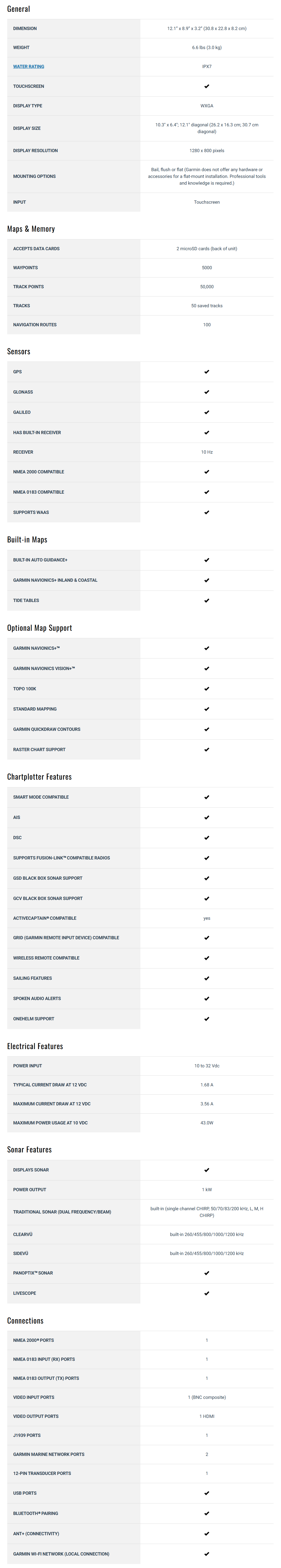
Especificaciones
En la caja
microSD™ card preinstalled
Power cable
NMEA 2000® T-connector
NMEA 2000 drop cable (2 meters)
8-pin transducer to 12-pin sounder adapter cable
Bail mount kit with knobs
Flush mount kit with gasket
Protective cover
Trim piece snap covers
Documentation
GMR 18 HD3 dome radar
Power cable (49.21 ft)
Network cable (49.21 ft)
Mounting hardware kit and template
Installation instructions
Manual y garantía
 Garmin Warranty
¿Tiene una unidad GPS vieja por ahí? El programa Trade In and Up de GPS Nation es una excelente manera de canjear su GPS viejo y usado por crédito para un nuevo GPS. ¡La decisión es completamente suya! Hemos simplificado y optimizado el proceso. Siga estos sencillos pasos y estará en camino de recibir crédito para su nuevo GPS.
1. Obtenga una cotización
Para obtener una cotización gratuita, proporcione el tipo, el fabricante, el modelo y el estado de su GPS. En un plazo de 24 horas, recibirá una cotización por el valor de intercambio de su producto actual. El formulario de intercambio de GPS se encuentra en la parte inferior de esta página.
2. Envíe su(s) producto(s) para comercializarlos
Después de aceptar nuestra oferta, empaquete sus productos de forma segura y envíenoslos utilizando la etiqueta de envío prepaga que le proporcionamos. Le enviaremos un correo electrónico de confirmación cuando su canje llegue a nuestro almacén. Tiene 30 días a partir de la fecha en que complete su canje en línea para enviar el producto a GPS Nation.
3. Realiza tu compra
Una vez que recibamos su producto en nuestro almacén y validemos la condición indicada, le enviaremos un correo electrónico de confirmación. Si elige recibir crédito para un nuevo GPS en gpsnation.com, se emitirá su crédito de la tienda y podrá realizar su compra.
Reseñas
Haz una pregunta
Especificaciones
En la caja
microSD™ card preinstalled
Power cable
NMEA 2000® T-connector
NMEA 2000 drop cable (2 meters)
8-pin transducer to 12-pin sounder adapter cable
Bail mount kit with knobs
Flush mount kit with gasket
Protective cover
Trim piece snap covers
Documentation
GMR 18 HD3 dome radar
Power cable (49.21 ft)
Network cable (49.21 ft)
Mounting hardware kit and template
Installation instructions
Manual y garantía
Programa de canje
¿Tiene una unidad GPS vieja por ahí? El programa Trade In and Up de GPS Nation es una excelente manera de canjear su GPS viejo y usado por crédito para un nuevo GPS. ¡La decisión es completamente suya! Hemos simplificado y optimizado el proceso. Siga estos sencillos pasos y estará en camino de recibir crédito para su nuevo GPS.
1. Obtenga una cotización
Para obtener una cotización gratuita, proporcione el tipo, el fabricante, el modelo y el estado de su GPS. En un plazo de 24 horas, recibirá una cotización por el valor de intercambio de su producto actual. El formulario de intercambio de GPS se encuentra en la parte inferior de esta página.
2. Envíe su(s) producto(s) para comercializarlos
Después de aceptar nuestra oferta, empaquete sus productos de forma segura y envíenoslos utilizando la etiqueta de envío prepaga que le proporcionamos. Le enviaremos un correo electrónico de confirmación cuando su canje llegue a nuestro almacén. Tiene 30 días a partir de la fecha en que complete su canje en línea para enviar el producto a GPS Nation.
3. Realiza tu compra
Una vez que recibamos su producto en nuestro almacén y validemos la condición indicada, le enviaremos un correo electrónico de confirmación. Si elige recibir crédito para un nuevo GPS en gpsnation.com, se emitirá su crédito de la tienda y podrá realizar su compra.
Descripción general
WIDEN YOUR HORIZONS
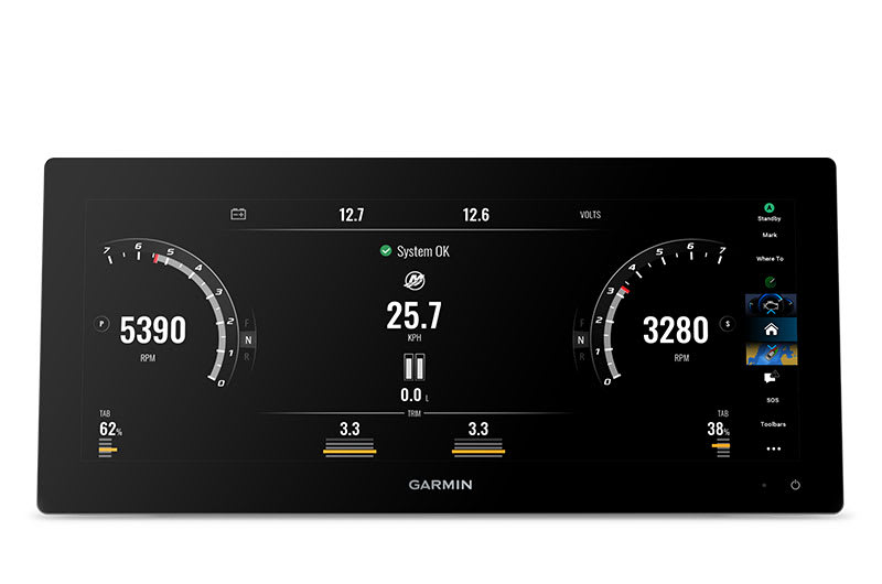
Offering a sleek aesthetic in an ultrawide edge-to-edge glass format, this advanced 15-inch chartplotter clearly expands your perspective at the helm. It is 74% wider and boasts more pixels than a standard 9-inch chartplotter, providing enhanced viewing clarity.
ULTRAWIDE IN-PLANE SWITCHING (IPS) 15-INCH DISPLAY FITS A VARIETY OF HELM LAYOUTS, INCLUDING “FLOATING DISPLAY” CONFIGURATIONS
CONNECT TO COMPATIBLE THIRD-PARTY DEVICES WITH DIGITAL SWITCHING AND ONEHELM™ INTEGRATIONS
EASILY BUILD YOUR MARINE SYSTEM BY USING OUR ADVANCED NETWORK CONNECTIVITY
NAVIGATE WATERS CONFIDENTLY WITH PRELOADED GARMIN NAVIONICS+™ CHARTS ON SELECT MODELS
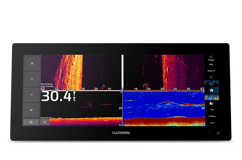
SEE BELOW YOUR BOAT WITH BUILT-IN SONAR CAPABILITIES
MANAGE YOUR MARINE EXPERIENCE FROM NEARLY ANYWHERE1

Gain a panoramic perspective.
SLEEK MODERN DESIGN
Offering a stunning display, with minimal trim borders and edge-to-edge glass, the GPSMAP 15x3 chartplotter features an ultrawide, high-resolution touchscreen interface with the familiar, easy-to-use functionality of our existing GPSMAP x3 series chartplotters.
BRIGHT AND CLEAR OPTICS
This versatile chartplotter’s ultrawide IPS display provides wider viewing angles, accurate colors, superior clarity and sunlight readability — even with polarized sunglasses.
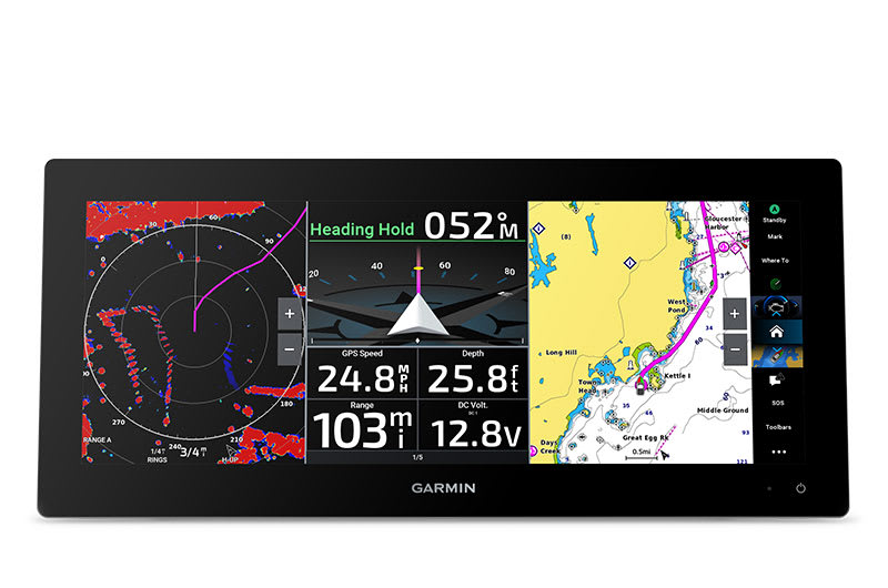
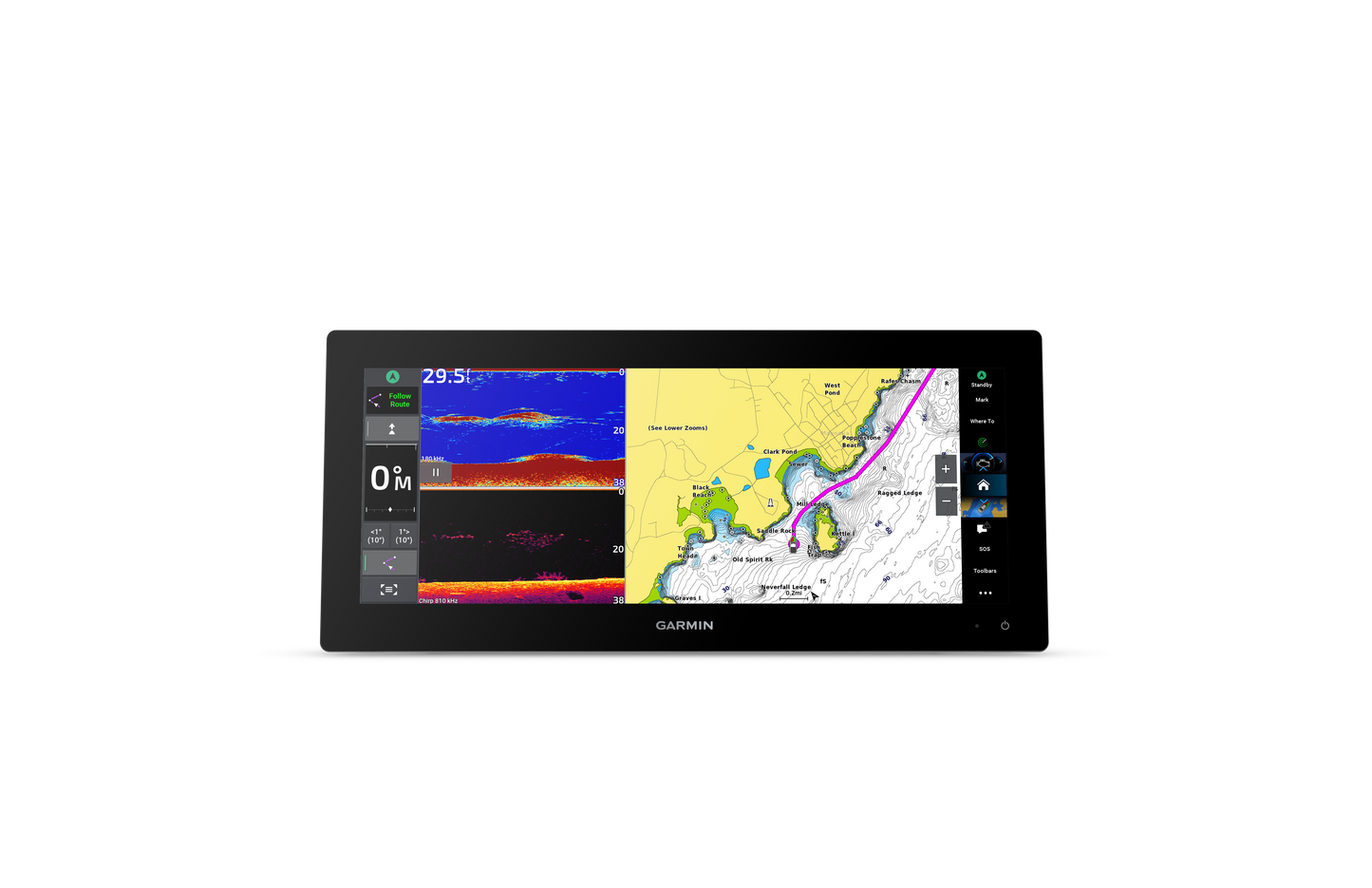
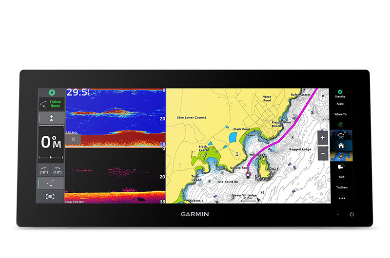
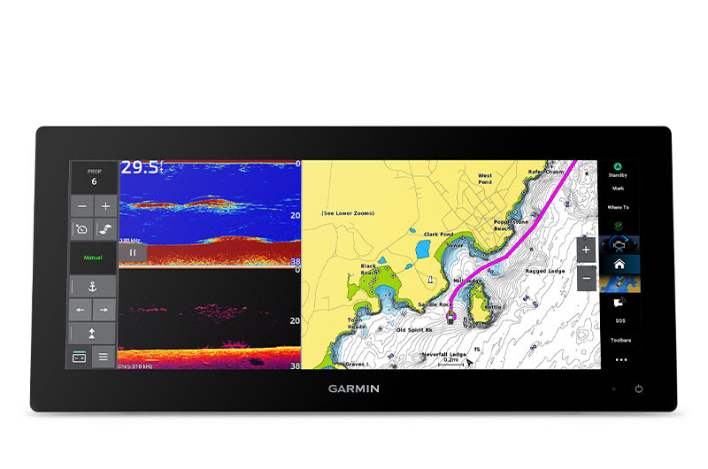
SPLIT TO FIT
Experience the benefits of dual screens with the convenience of seamless control. Split-screen functionality lets you size and organize your display configuration to put the data you need right where you want it.
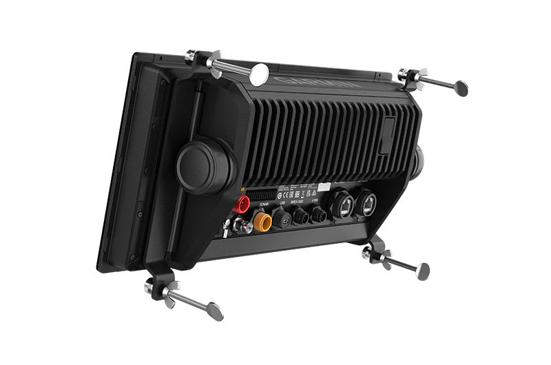
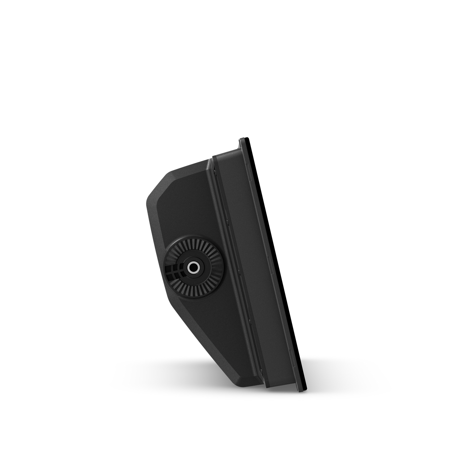
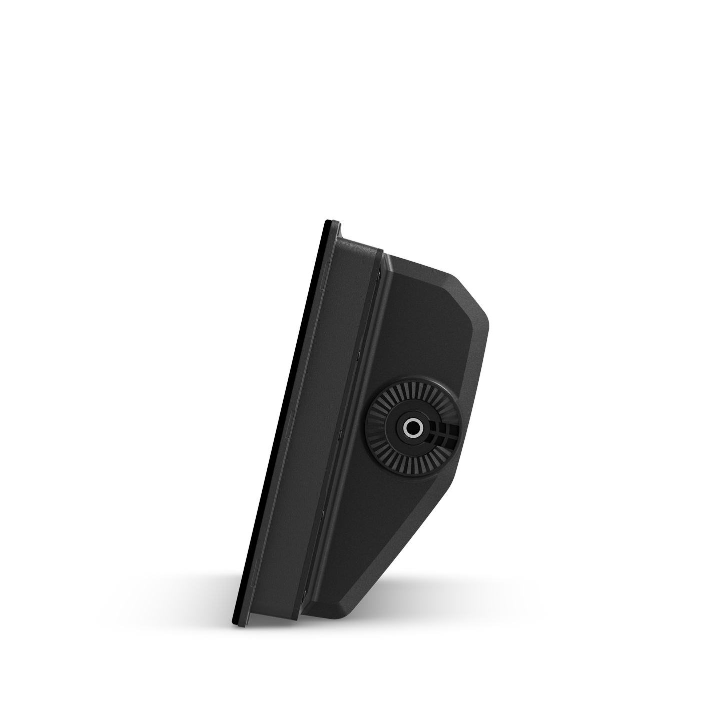
TWO MOUNTING OPTIONS
A bail-mount option with inset knobs and a bracket supports unique “floating display” installations, while a rear-mount option is provided for secure flush- and flat-mount helm solutions.
See the world below.
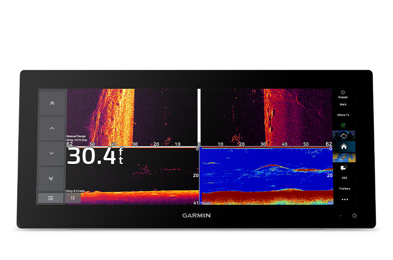
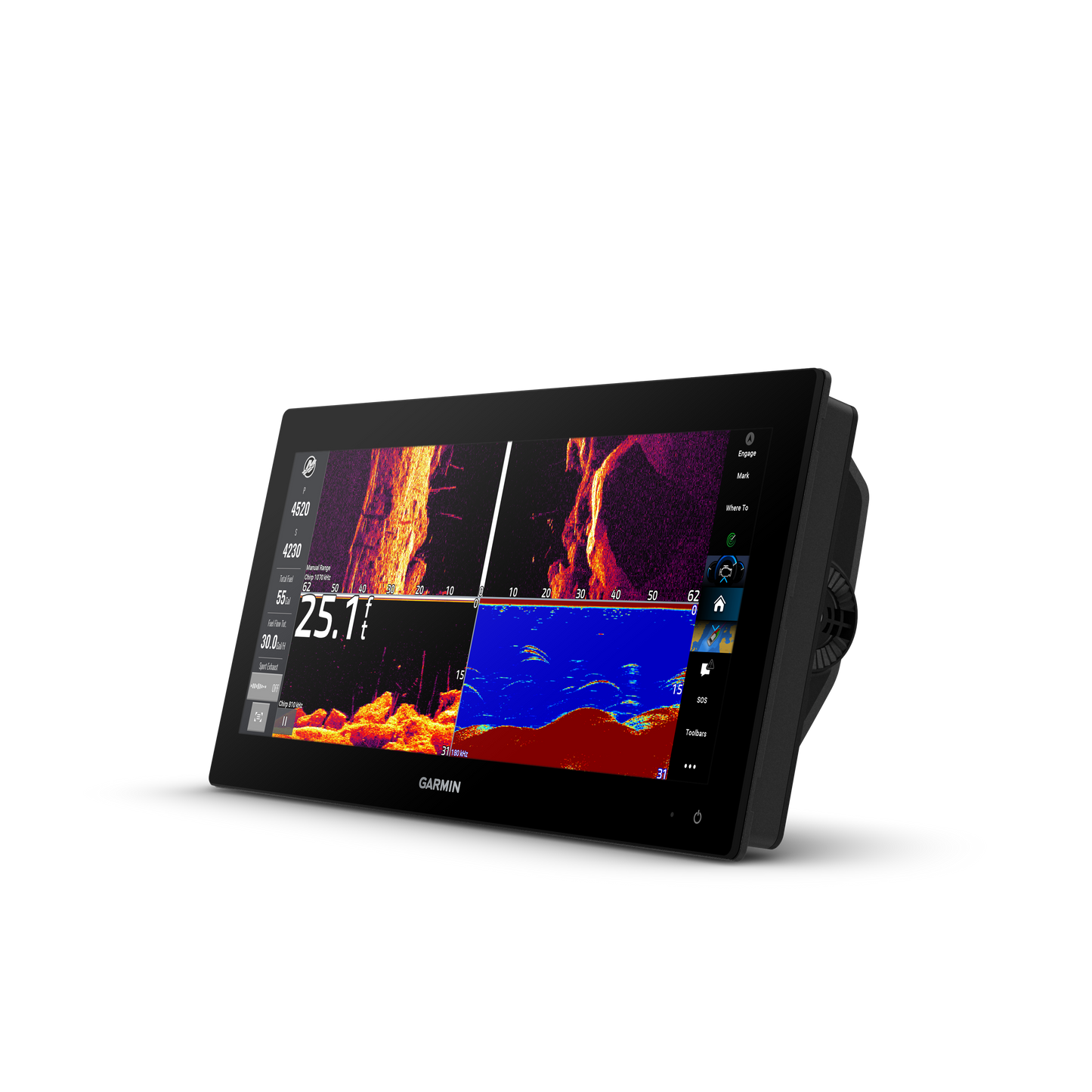
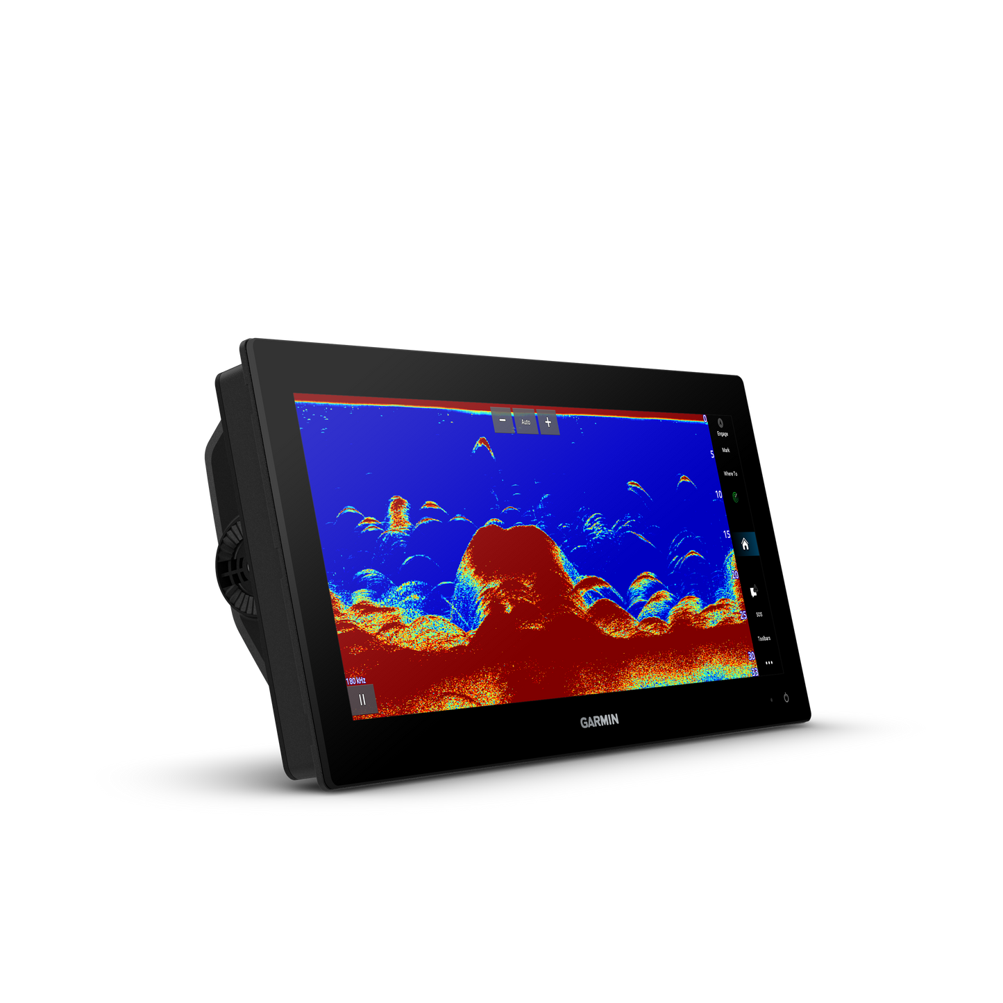
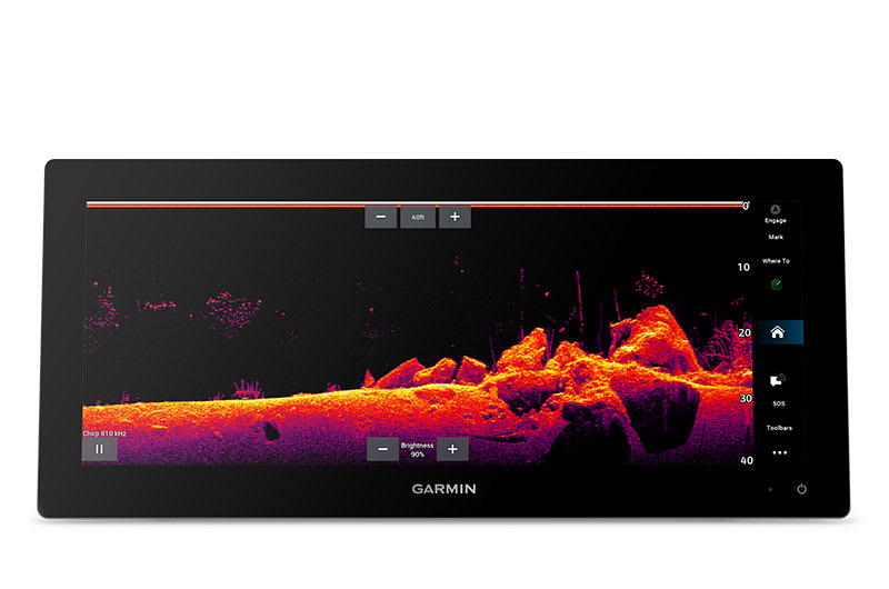
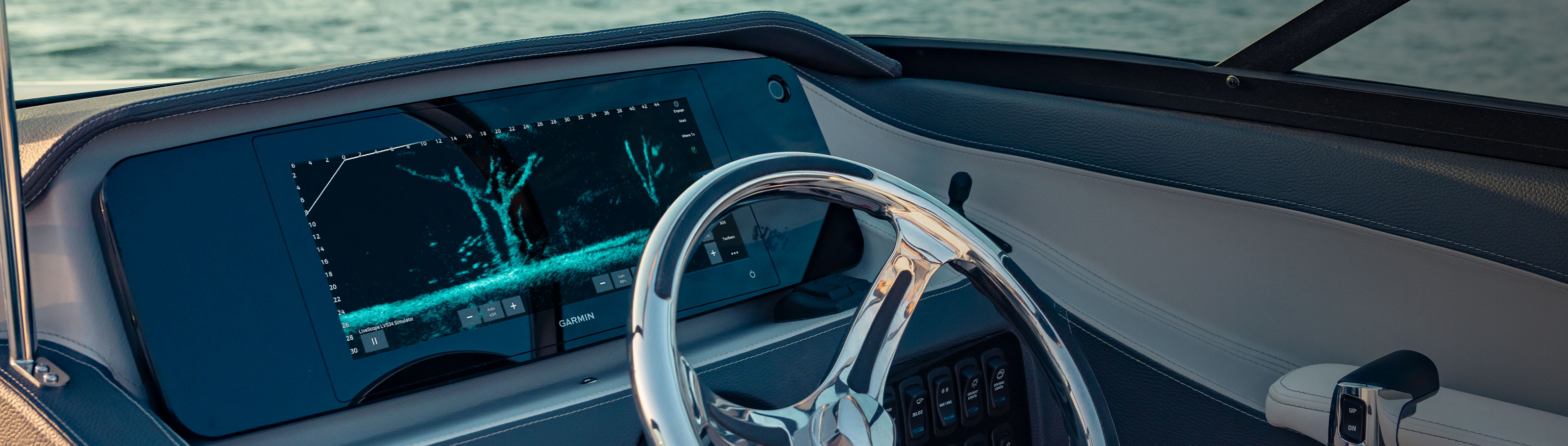
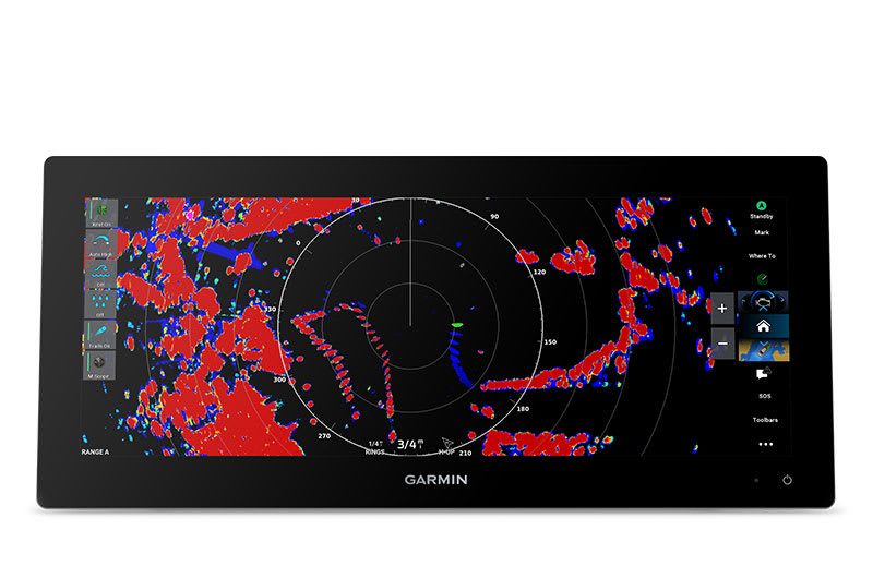
TRADITIONAL AND SCANNING SONAR SUPPORT
Get built-in support for 1 kW CHIRP traditional sonar for superior target separation. Plus, Ultra High-Definition ClearVü™ and SideVü™ scanning sonars feature vivid, high-contrast color palettes to help distinguish fish from structure (transducer required; sold separately).
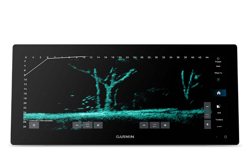
LIVE SONAR SUPPORT
Pair with Panoptix™ or LiveScope™ easy-to-interpret live sonar (transducer required; sold separately) to see all around your boat in real time.
Made for your helm.
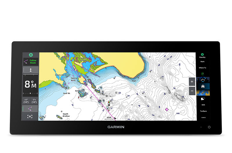
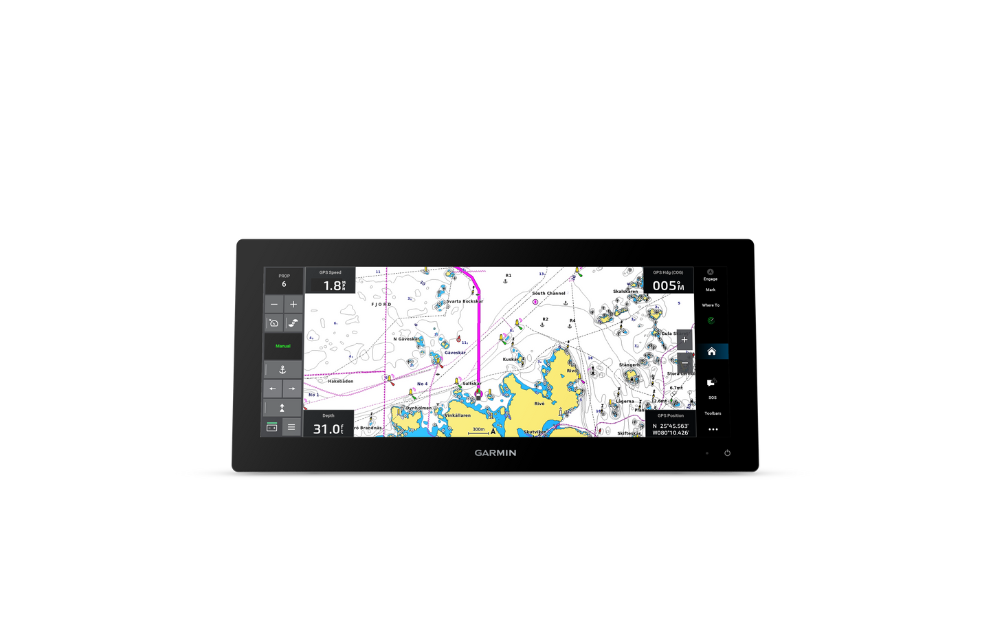
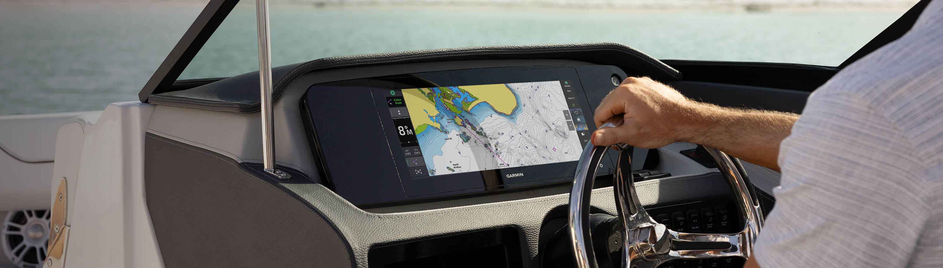
PRELOADED MAPPING
Experience unparalleled coverage and detail with built-in Garmin Navionics+ integrated coastal and inland mapping that includes Auto Guidance+™ technology2 and a 1-year subscription for downloadable daily updates and more on select models.
OPTIONAL CHARTS AND MAPS
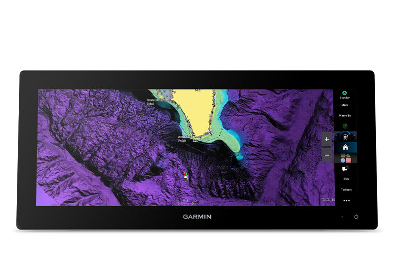
Bring premium chart features to your chartplotter with an optional upgrade to a Garmin Navionics Vision+™ subscription, featuring downloadable high-resolution relief shading, satellite imagery, sonar imagery and more.

Sail and navigate with ease.
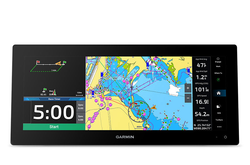
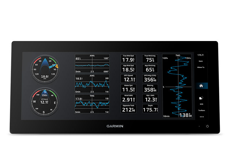
GARMIN SAILASSIST™ SAILING FEATURES
View laylines, race start line guidance, enhanced wind rose, heading and course-over-ground lines, true wind data fields and tide/current/time slider, wind angle, set and drift, wind speed and more.
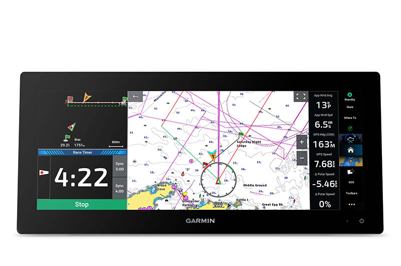
SAILING POLARS
Use the polar table to see key data, including how fast you should go at a certain wind angle and speed — so you know whether you need to adjust sail trim.
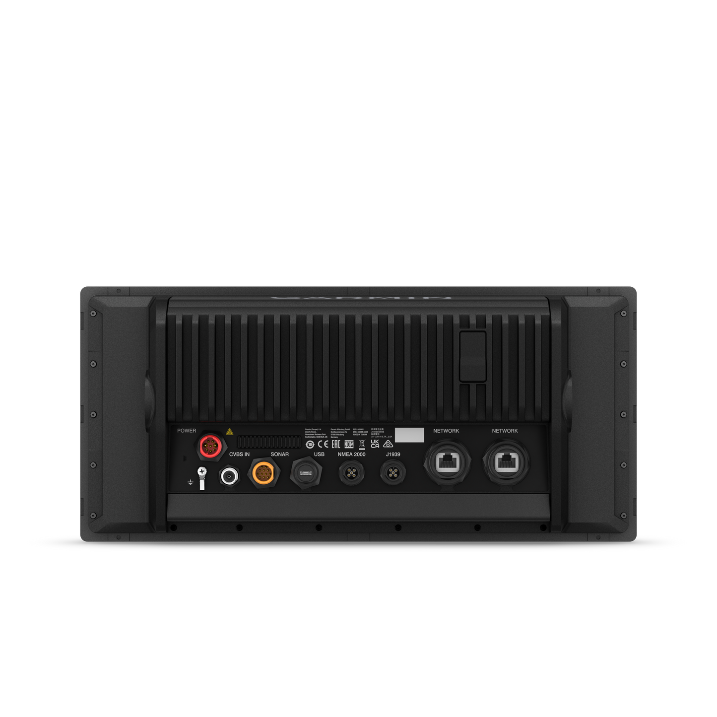
GARMIN MARINE NETWORK
If you have multiple compatible Garmin devices on your boat, you can share information — such as maps, user data, radar and IP camera video — among them.
NMEA 2000® AND NMEA 0183 NETWORKS
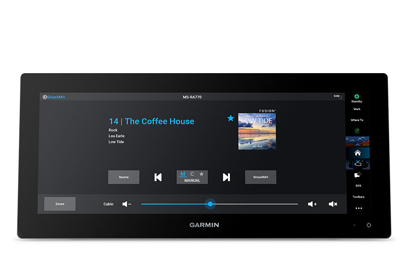
Connect to compatible autopilots, digital switching, weather, the Fusion® audio system, media, VHF, AIS and more from one screen.
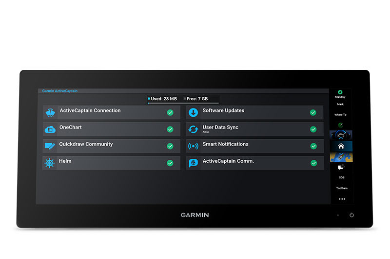
ACTIVECAPTAIN® APP
Built-in Wi-Fi® connectivity pairs with the free all-in-one mobile app for access to the OneChart™ feature, smart notifications (when paired with your smartphone), software updates, Helm™ app, Garmin Quickdraw™ Community data and more1.
INTEGRATED ANT® TECHNOLOGY
Connect with some of your favorite devices, such as quatix® marine watches, gWind™ Wireless 2 transducers, GNX™ Wind marine instruments and wireless remote controls.
ENGINE CONNECTIVITY
You can connect your chartplotter to different engines, including select Yamaha® and Mercury® engines.
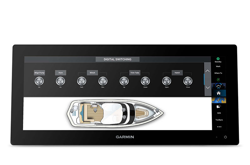
ONEHELM FEATURE
This feature brings together all of the operations and capabilities of EmpirBus™ digital switching and other third-party devices on one screen.

SEND INREACH® DEVICE MESSAGES
Pair your inReach satellite communicator3 to your chartplotter, and type custom messages by using your MFD’s on-screen keyboard. Access your contact list, or enter an email, inReach address or phone number. You can also group messages by conversation for a texting-like experience.

Connect with additional boat control options.
POWER-POLE® SHALLOW WATER ANCHOR
By networking the GPSMAP 15x3 chartplotter with your Force® trolling motor and your compatible Power-Pole shallow water anchoring system, you can access advanced boat control features4 from your plotter, including smart anchor auto-deployment, smart anchor jog, auto stow, anchor drag detection and end-of-route anchoring. Spend more time fishing, less time positioning.
TROLLING MOTOR INTEGRATION
Get support and integration for your Force series trolling motor (sold separately) to gain more control while you fish.


