


Garmin GPSMAP 8612xsv With Mapping and Sonar (010-02092-51)
Garmin GPSMAP 8612xsv With Mapping and Sonar (010-02092-51)
SKU: 010-02092-51
Bajas existencias
 WhatsApp
 SMS - Text us!
 Email Us!
 Help Desk
Reseñas
Especificaciones

En la caja
Power cable
NMEA 2000® drop cable
NMEA 2000 T-connector
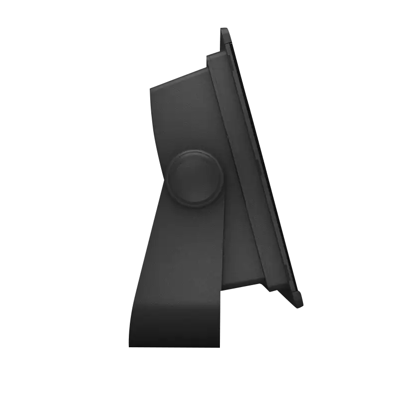
Bail mount with knobs
Flush mount kit
Sun cover
Trim piece snap covers
Documentation
¿Tiene una unidad GPS vieja por ahí? El programa Trade In and Up de GPS Nation es una excelente manera de canjear su GPS viejo y usado por crédito para un nuevo GPS. ¡La decisión es completamente suya! Hemos simplificado y optimizado el proceso. Siga estos sencillos pasos y estará en camino de recibir crédito para su nuevo GPS.
1. Obtenga una cotización
Para obtener una cotización gratuita, proporcione el tipo, el fabricante, el modelo y el estado de su GPS. En un plazo de 24 horas, recibirá una cotización por el valor de intercambio de su producto actual. El formulario de intercambio de GPS se encuentra en la parte inferior de esta página.
2. Envíe su(s) producto(s) para comercializarlos
Después de aceptar nuestra oferta, empaquete sus productos de forma segura y envíenoslos utilizando la etiqueta de envío prepaga que le proporcionamos. Le enviaremos un correo electrónico de confirmación cuando su canje llegue a nuestro almacén. Tiene 30 días a partir de la fecha en que complete su canje en línea para enviar el producto a GPS Nation.
3. Realiza tu compra
Una vez que recibamos su producto en nuestro almacén y validemos la condición indicada, le enviaremos un correo electrónico de confirmación. Si elige recibir crédito para un nuevo GPS en gpsnation.com, se emitirá su crédito de la tienda y podrá realizar su compra.
Manual y garantía
 Garmin Warranty
Reseñas
Haz una pregunta
Especificaciones
En la caja
Power cable
NMEA 2000® drop cable
NMEA 2000 T-connector
Bail mount with knobs
Flush mount kit
Sun cover
Trim piece snap covers
Documentation
Programa de canje
¿Tiene una unidad GPS vieja por ahí? El programa Trade In and Up de GPS Nation es una excelente manera de canjear su GPS viejo y usado por crédito para un nuevo GPS. ¡La decisión es completamente suya! Hemos simplificado y optimizado el proceso. Siga estos sencillos pasos y estará en camino de recibir crédito para su nuevo GPS.
1. Obtenga una cotización
Para obtener una cotización gratuita, proporcione el tipo, el fabricante, el modelo y el estado de su GPS. En un plazo de 24 horas, recibirá una cotización por el valor de intercambio de su producto actual. El formulario de intercambio de GPS se encuentra en la parte inferior de esta página.
2. Envíe su(s) producto(s) para comercializarlos
Después de aceptar nuestra oferta, empaquete sus productos de forma segura y envíenoslos utilizando la etiqueta de envío prepaga que le proporcionamos. Le enviaremos un correo electrónico de confirmación cuando su canje llegue a nuestro almacén. Tiene 30 días a partir de la fecha en que complete su canje en línea para enviar el producto a GPS Nation.
3. Realiza tu compra
Una vez que recibamos su producto en nuestro almacén y validemos la condición indicada, le enviaremos un correo electrónico de confirmación. Si elige recibir crédito para un nuevo GPS en gpsnation.com, se emitirá su crédito de la tienda y podrá realizar su compra.
Manual y garantía
Descripción general
Garmin GPSMAP 8612xsv Marine Chartplotter with Integrated Sonar and Navionics+ Mapping
Introduction
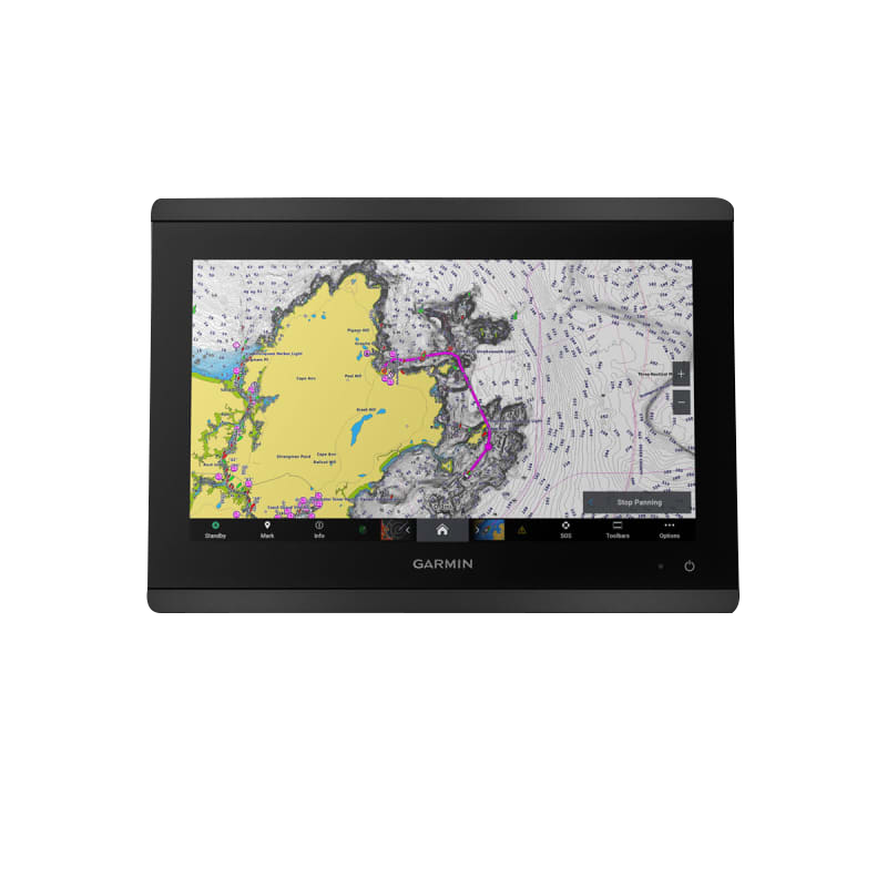
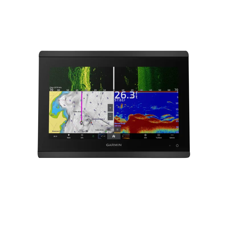
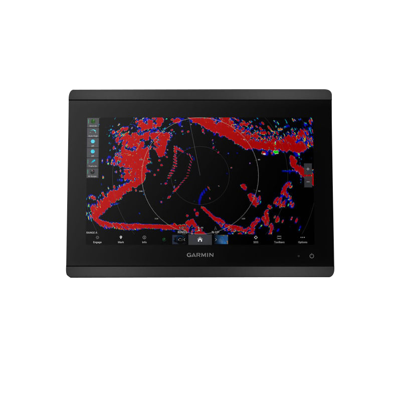
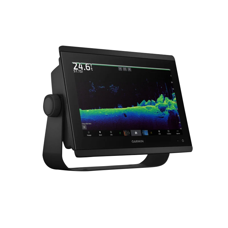
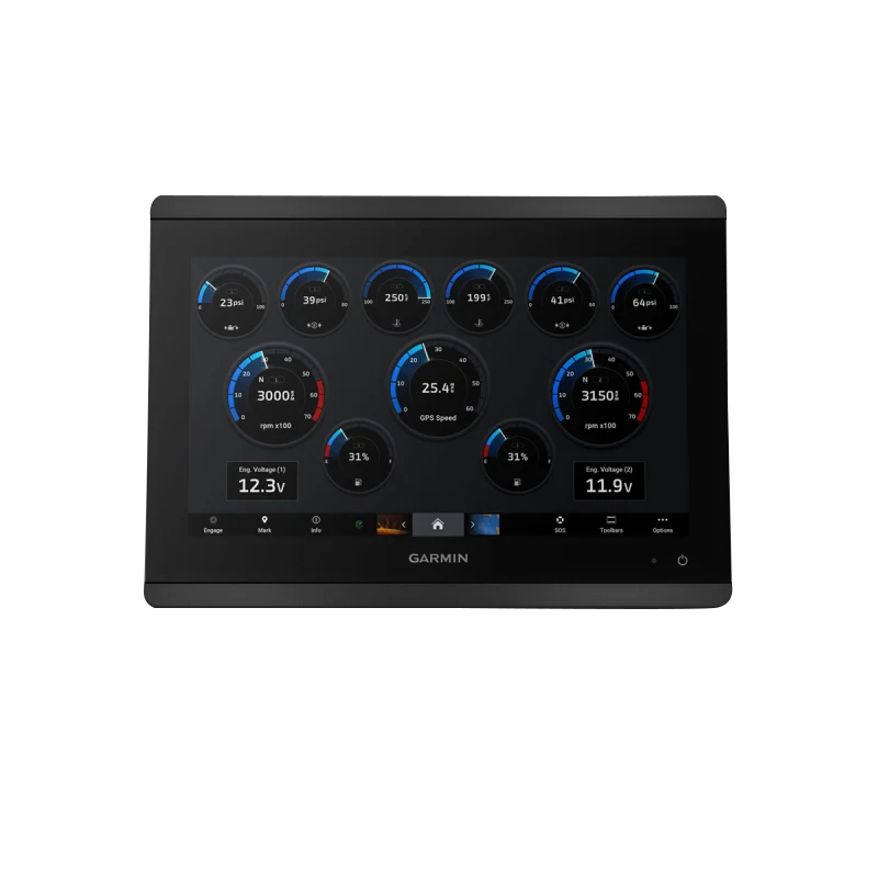
The Garmin GPSMAP 8612xsv combines professional-grade navigation with integrated sonar in a single deck-mounted unit, delivering real-time underwater imaging and chart-based navigation for anglers, cruisers, sailors, and racers who need precise positioning and fish-finding capability. The Full HD IPS touchscreen displays high-resolution mapping and sonar data simultaneously, allowing you to navigate confidently while scanning the water column below your vessel in real time.
Key Features
- Full HD IPS touchscreen with sunlight-readable display and high-contrast clarity across 10" to 24" screen sizes
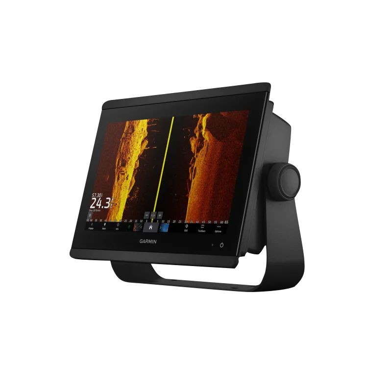
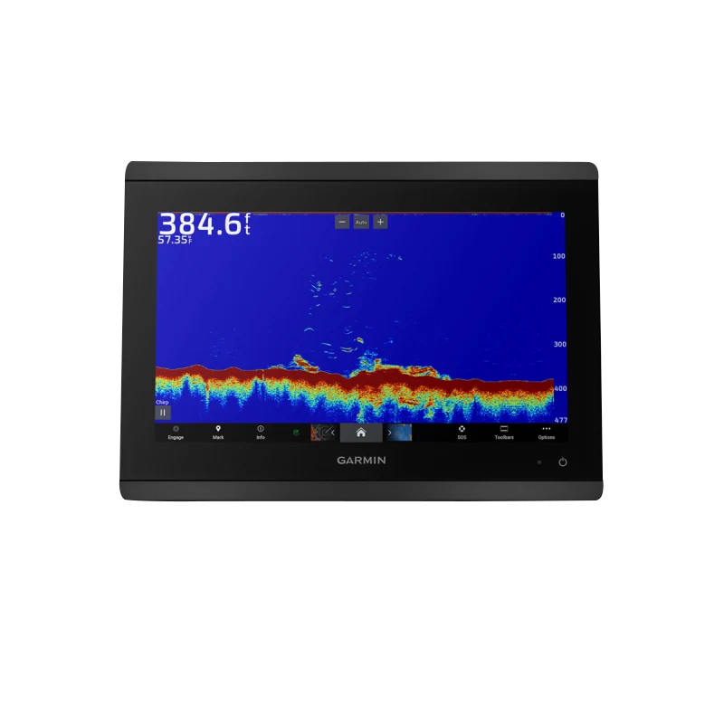
- 1-kW Dual-Channel CHIRP sonar with deep water scanning capability reaching 1,000 feet below the surface
- Built-in Garmin Navionics+ mapping with automatic daily chart updates and continuous map enhancement via cloud connectivity
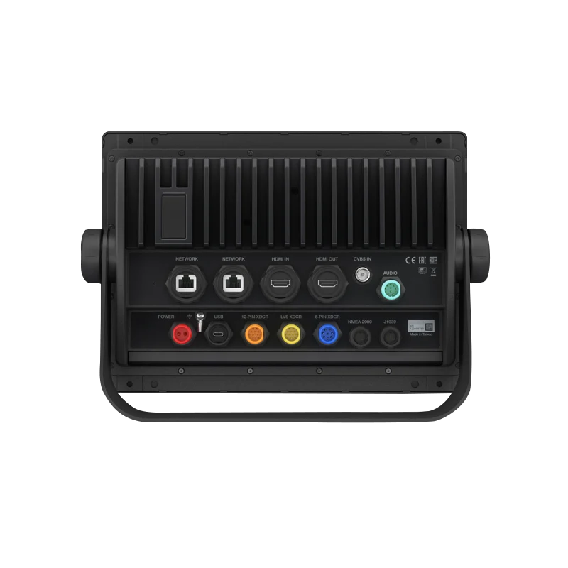
- NMEA 2000 and NMEA 0183 network compatibility for seamless integration with autopilot, engines, and other marine electronics
- SailAssist racing tool set including real-time wind overlay, tactical laylines, and start-line management
- inReach satellite communication integration when paired with compatible satellite communicator for messaging beyond cellular coverage
Data Insights
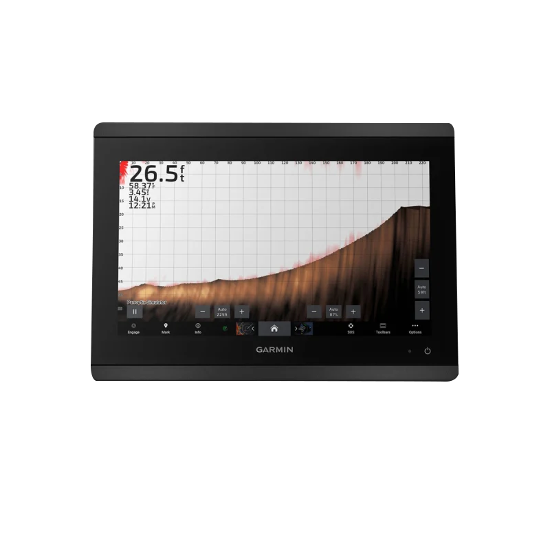
Field studies demonstrate that anglers utilizing advanced sonar features on marine-grade chartplotters achieve catch rate improvements of up to 30% compared to visual-only navigation methods. The GPSMAP 8612xsv's dual-channel CHIRP sonar provides distinct frequency separation, allowing simultaneous scanning at different depths for comprehensive target identification. Real-time bathymetric overlay on Navionics+ charts helps identify structure and drop-offs where fish congregate, while side-imaging and down-imaging sonar modes reveal underwater terrain with clarity that exceeds traditional single-frequency systems.
Usage Instructions
Mount the GPSMAP 8612xsv securely on your vessel's helm using either the flat-mount or flush-mount bracket, positioning it within arm's reach of your normal operating position. Power the unit through the NMEA 2000 backbone or direct 12/24V connection, then activate Navionics+ to receive automatic daily map updates. Configure sonar transducer frequency based on water depth and target type, then use the touchscreen or optional GRID 20 remote control to access chart views, sonar displays, and vessel management functions during operation.
Design & Material
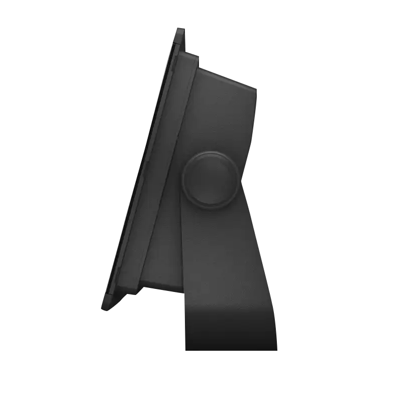
The GPSMAP 8612xsv features a compact, modular design that mounts flush or flat against helm consoles typical of offshore and inland vessels. Its marine-grade construction withstands constant saltwater exposure and mechanical vibration while maintaining full operational capability in bright sunlight and extreme weather. The intuitive interface balances touchscreen control with physical button access for critical navigation functions, and the device integrates cleanly with vessel aesthetics across cruising, fishing, and racing platforms.
- High-quality marine-grade polymer bezel and housing resistant to UV fading and saltwater corrosion
- Flat-Mount and Flush-Mount bracket options for flexible installation across different helm console designs
- GRID 20 wireless remote control included for helm-to-cabin navigation and map panning without leaving the wheel
- SmartMode Station Controls providing one-touch access to sonar, chart, and system settings via customizable profile buttons
- Polarized anti-glare IPS panel coating minimizes screen reflection in direct sunlight while preserving color accuracy
- Sealed connector ports rated for continuous marine operation with integrated drainage to prevent moisture accumulation
Final Verdict
The Garmin GPSMAP 8612xsv delivers professional sonar and navigation capability in a single integrated system, eliminating the need for separate chartplotters and fish finders while saving helm space and installation complexity. If you navigate inland waterways, coastal routes, or open ocean while targeting fish or racing competitively, the combination of real-time sonar feedback, daily-updated Navionics+ charts, and extensive connectivity to marine electronics makes this chartplotter an essential upgrade. Equip your vessel with the GPSMAP 8612xsv today and gain the navigational confidence and catch success that professional-grade marine electronics deliver.


