


Garmin GPSMAP 86sci Marine Handheld With BlueChart g3 Coastal Charts and inReach Capabilities (010-02236-02)
Garmin GPSMAP 86sci Marine Handheld With BlueChart g3 Coastal Charts and inReach Capabilities (010-02236-02)
SKU: 010-02236-02
Agotado
 WhatsApp
 SMS - Text us!
 Email Us!
 Help Desk
Reseñas
Especificaciones

En la caja
Powered mount
Lanyard
USB to Micro USB cable
USB to 2 pin cable
Mounting hardware
Documentation
¿Tiene una unidad GPS vieja por ahí? El programa Trade In and Up de GPS Nation es una excelente manera de canjear su GPS viejo y usado por crédito para un nuevo GPS. ¡La decisión es completamente suya! Hemos simplificado y optimizado el proceso. Siga estos sencillos pasos y estará en camino de recibir crédito para su nuevo GPS.
1. Obtenga una cotización
Para obtener una cotización gratuita, proporcione el tipo, el fabricante, el modelo y el estado de su GPS. En un plazo de 24 horas, recibirá una cotización por el valor de intercambio de su producto actual. El formulario de intercambio de GPS se encuentra en la parte inferior de esta página.
2. Envíe su(s) producto(s) para comercializarlos
Después de aceptar nuestra oferta, empaquete sus productos de forma segura y envíenoslos utilizando la etiqueta de envío prepaga que le proporcionamos. Le enviaremos un correo electrónico de confirmación cuando su canje llegue a nuestro almacén. Tiene 30 días a partir de la fecha en que complete su canje en línea para enviar el producto a GPS Nation.
3. Realiza tu compra
Una vez que recibamos su producto en nuestro almacén y validemos la condición indicada, le enviaremos un correo electrónico de confirmación. Si elige recibir crédito para un nuevo GPS en gpsnation.com, se emitirá su crédito de la tienda y podrá realizar su compra.
Manual y garantía
Reseñas
Haz una pregunta
Especificaciones
En la caja
Powered mount
Lanyard
USB to Micro USB cable
USB to 2 pin cable
Mounting hardware
Documentation
Programa de canje
¿Tiene una unidad GPS vieja por ahí? El programa Trade In and Up de GPS Nation es una excelente manera de canjear su GPS viejo y usado por crédito para un nuevo GPS. ¡La decisión es completamente suya! Hemos simplificado y optimizado el proceso. Siga estos sencillos pasos y estará en camino de recibir crédito para su nuevo GPS.
1. Obtenga una cotización
Para obtener una cotización gratuita, proporcione el tipo, el fabricante, el modelo y el estado de su GPS. En un plazo de 24 horas, recibirá una cotización por el valor de intercambio de su producto actual. El formulario de intercambio de GPS se encuentra en la parte inferior de esta página.
2. Envíe su(s) producto(s) para comercializarlos
Después de aceptar nuestra oferta, empaquete sus productos de forma segura y envíenoslos utilizando la etiqueta de envío prepaga que le proporcionamos. Le enviaremos un correo electrónico de confirmación cuando su canje llegue a nuestro almacén. Tiene 30 días a partir de la fecha en que complete su canje en línea para enviar el producto a GPS Nation.
3. Realiza tu compra
Una vez que recibamos su producto en nuestro almacén y validemos la condición indicada, le enviaremos un correo electrónico de confirmación. Si elige recibir crédito para un nuevo GPS en gpsnation.com, se emitirá su crédito de la tienda y podrá realizar su compra.
Manual y garantía
Descripción general
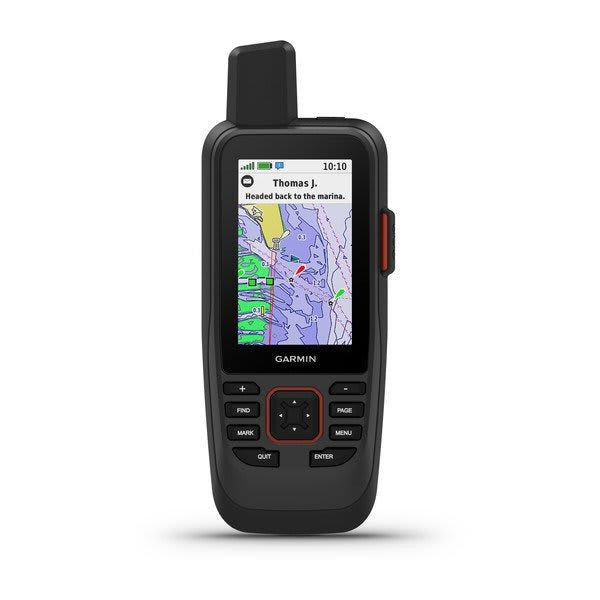
Garmin GPSMAP 86sci Marine Handheld GPS with BlueChart g3 Charts and inReach Satellite Communication
Introduction
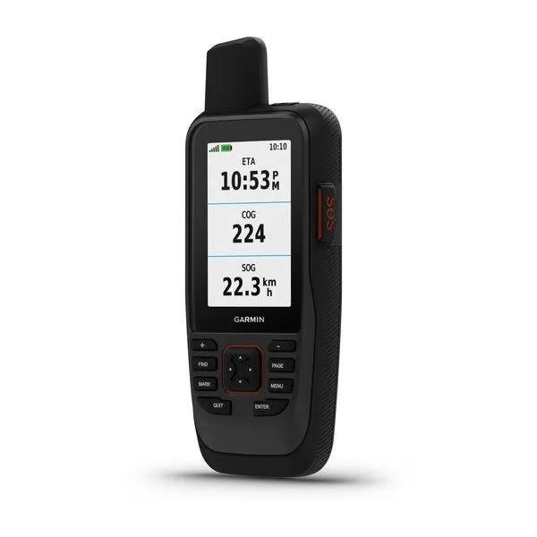
The Garmin GPSMAP 86sci is a rugged, floating marine handheld GPS engineered for offshore navigation and remote communication where cellular coverage ends. This device combines detailed coastal mapping with global satellite messaging and emergency SOS functionality, making it an essential primary navigator or dependable backup system for boating, fishing, sailing, and extended marine expeditions. Unlike traditional marine handhelds, the GPSMAP 86sci integrates two-way inReach satellite communication directly into the device, allowing users to send and receive text messages, emails, and location updates anywhere worldwide through the Iridium satellite network when paired with an active subscription. The floating design, water-resistant construction, and extended battery capacity deliver reliability in demanding marine conditions where conventional GPS and cellular solutions fail.
Key Features
- Preloaded BlueChart g3 coastal charts with integrated Garmin and Navionics mapping data for comprehensive chart coverage
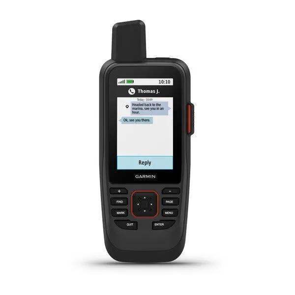
- Global two-way inReach satellite messaging and email capability through the Iridium satellite network with delivery confirmation
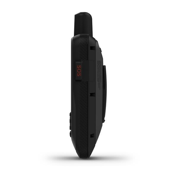
- Interactive SOS functionality connecting directly to Garmin emergency response coordinators with 24/7 monitoring support
- Real-time boat data syncing with compatible Garmin chartplotters, displaying vessel information and enhanced situational awareness
- ABC sensors including built-in altimeter, integrated barometer, and 3-axis electronic compass for accurate navigation and environmental monitoring
- Extended battery life delivering up to 40 hours in standard mode and up to 200 hours in expedition mode with rechargeable lithium battery
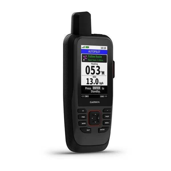
- Remote control capability for compatible Garmin autopilot systems, allowing users to change vessel heading and engage pattern steering from the handheld
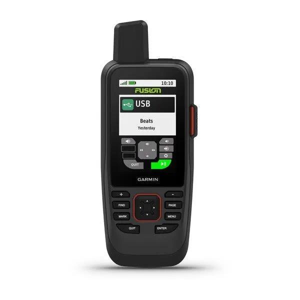
- Fusion-Link audio control for seamless management of compatible Garmin Fusion marine audio systems from the device
- Floating design that remains buoyant if dropped overboard, combined with water-resistant construction for marine environment durability
- Adjustable GPS filtering providing smooth speed and heading indications improved accuracy over waves and swells
- Built-in LED flashlight serving as both an onboard light source and emergency signaling beacon
- WiFi and Bluetooth wireless connectivity enabling easy software updates, device pairing, and smart notifications from compatible smartphones
- ANT+ technology support for expanded ecosystem integration with compatible marine devices
- Marine weather forecast delivery directly to the device, improving trip planning and decision-making on the water
- Garmin Explore compatibility for cloud-based waypoint management, route synchronization, and trip planning tools
Data Insights
The GPSMAP 86sci delivers exceptional battery performance for extended marine operations, with users achieving up to 40 hours of continuous navigation in standard mode and extending that to 200 hours when operating in expedition mode with reduced screen brightness. This substantial difference in battery life—a five-fold increase—demonstrates the device's flexibility for both day trips and multi-day offshore adventures. The integration of dual mapping sources through BlueChart g3 ensures coverage consistency while combining proprietary Garmin data with Navionics charting detail. Real-time syncing with compatible Garmin chartplotters allows the handheld to function as a remote navigation and system monitoring terminal, eliminating the need for separate communication between helm and crew on larger vessels.
Usage Instructions
Power on the GPSMAP 86sci and allow several moments for satellite acquisition before navigating. Access the preloaded BlueChart g3 charts to create waypoints, plot routes, and monitor your vessel's position in real time. Pair the device wirelessly with compatible Garmin marine chartplotters, autopilot systems, Fusion audio equipment, and smartphones to unlock integrated functionality and remote control capabilities. To activate inReach messaging, marine weather, trip tracking, and SOS features, configure an active satellite subscription through Garmin and establish your communication preferences in the device settings. Periodically synchronize waypoints, routes, and tracks through the Garmin Explore cloud platform for backup and cross-device access. Recharge the internal lithium battery as required using the included charging cable, with charge time varying based on remaining battery capacity.
Design & Material
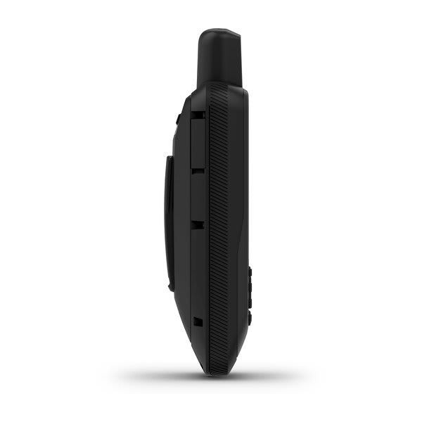
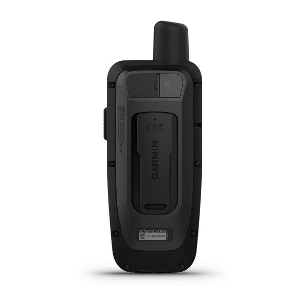
The GPSMAP 86sci employs a robust handheld form factor optimized for one-handed operation while delivering advanced navigation and communication capabilities. Its industrial-grade construction prioritizes durability in harsh marine environments without sacrificing ergonomic comfort during extended use. The device's compact dimensions balance screen real estate with portability, making it practical for stowage aboard small vessels, kayaks, and in emergency survival kits.
- Water-resistant housing engineered to withstand exposure to saltwater spray, rain, and washdown without compromising internal electronics
- Floating design with positive buoyancy ensures device recovery if dropped overboard during boarding, line handling, or emergency situations
- Rubberized grip surface provides secure handling even when wet or wearing marine gloves, reducing accidental slips on deck
- Physical button interface with tactile feedback allows intuitive navigation during rough sea states when touchscreen operation becomes impractical
- Rechargeable lithium battery housed in a sealed compartment with dedicated charge port prevents water ingress while enabling field replacement
- Built-in LED flashlight integrated into the device frame serves dual purpose as work light and emergency signaling beacon without requiring external attachments
Final Verdict
The Garmin GPSMAP 86sci represents the definitive choice for mariners who demand navigation, communication, and safety in a single rugged device. Its combination of preloaded BlueChart g3 coastal charts, real-time inReach satellite messaging with SOS functionality, extended battery capacity, and floating water-resistant design makes it indispensable for offshore fishing, remote cruising, sailing expeditions, and marine rescues. Whether you need a primary handheld navigator for navigating coastal waters or a trusted backup system for extended ocean passages, the GPSMAP 86sci delivers the reliability, global connectivity, and emergency capabilities that serious mariners require when operating beyond cellular coverage and beyond the sight of shore. Invest in this device to ensure confident navigation, reliable communication, and professional-grade safety monitoring during your next marine adventure.


